Adorf night lights from space
Night Light of Adorf (Saxony) from space (Germany) Src. Average luminocity for 10x10km area is 1.8697% and for 50x50km: 2.9852%.
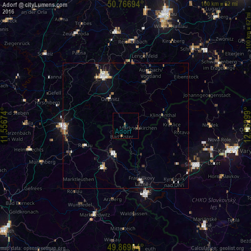
Analysis of Adorf night lights 2016
Square area 10x10 km:
 0%
0%90-99
0%80-89
0%70-79
1.12%60-69
0.28%50-59
0%40-49
0.56%30-39
1.26%20-29
0.14%10-19
0%0-9
96.64%Square area 50x50 km:
0.44%90-99
0.46%80-89
0.31%70-79
0.32%60-69
0.25%50-59
0.42%40-49
0.41%30-39
0.49%20-29
0.27%10-19
1.54%0-9
95.07%Clear (daylight) street map image can be seen on geolist.org.
Map coordinates:
50° 46' 1" North, 11° 33' 24.3" East
50° 19' 12.4" North, 12° 15' 35.5" East
49° 52' 8.5" North, 12° 57' 46.8" East
Some cities around Adorf sort by population:
• Selb
19 km =11.8 mi,  208°
208°
• Aš, CZ
11.7 km =7.3 mi,  203°
203°
• Oelsnitz
12.3 km =7.6 mi,  328°
328°
• Rehau
17.9 km =11.1 mi,  243°
243°
• Falkenstein
19.2 km =11.9 mi,  24°
24°
• Klingenthal
15.2 km =9.4 mi,  73°
73°
• Kraslice, CZ
18.3 km =11.4 mi,  88°
88°
• Markneukirchen
5 km =3.1 mi,  101°
101°
2959390 (p: 5,806)
Sources (retrieved 2019-11-25):
» Earth at Night: Flat Maps 2012, 2016