Aš night lights from space
Night Light of Aš (Karlovarský kraj) from space (Czech Republic) Src. Average luminocity for 10x10km area is 8.7219% and for 50x50km: 2.86%.
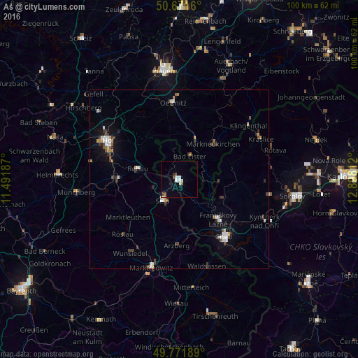
Analysis of Aš night lights 2016
Square area 10x10 km:
 1.47%
1.47%90-99
2.67%80-89
0.53%70-79
0.27%60-69
0.4%50-59
1.87%40-49
0.4%30-39
0.53%20-29
0%10-19
0.13%0-9
91.71%Square area 50x50 km:
0.47%90-99
0.57%80-89
0.18%70-79
0.24%60-69
0.19%50-59
0.33%40-49
0.44%30-39
0.63%20-29
0.25%10-19
1.11%0-9
95.59%Clear (daylight) street map image can be seen on geolist.org.
Map coordinates:
50° 40' 17.8" North, 11° 29' 30.7" East
50° 13' 25.9" North, 12° 11' 42" East
49° 46' 18.8" North, 12° 53' 53.2" East
Some cities around Aš sort by population:
• Selb, DE
7.5 km =4.7 mi,  217°
217°
• Schwarzenbach an der Saale, DE
18.5 km =11.5 mi,  269°
269°
• Rehau, DE
11.8 km =7.3 mi,  283°
283°
• Markneukirchen, DE
13.6 km =8.5 mi,  44°
44°
• Arzberg, DE
18.5 km =11.5 mi,  181°
181°
• Oberkotzau, DE
19 km =11.8 mi, 283°
• Adorf, DE
11.7 km =7.3 mi,  23°
23°
• Františkovy Lázně
16 km =9.9 mi,  135°
135°
3079751 (p: 12,866)
Sources (retrieved 2019-11-25):
» Earth at Night: Flat Maps 2012, 2016