Rehau night lights from space
Night Light of Rehau (Bavaria) from space (Germany) Src. Average luminocity for 10x10km area is 2.4826% and for 50x50km: 2.8934%.
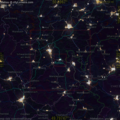
Analysis of Rehau night lights 2016
Square area 10x10 km:
 0.53%
0.53%90-99
0.53%80-89
0.13%70-79
0.4%60-69
0%50-59
0%40-49
0%30-39
0.53%20-29
0.27%10-19
1.07%0-9
96.52%Square area 50x50 km:
0.46%90-99
0.53%80-89
0.17%70-79
0.3%60-69
0.19%50-59
0.39%40-49
0.48%30-39
0.54%20-29
0.16%10-19
1.27%0-9
95.49%Clear (daylight) street map image can be seen on geolist.org.
Map coordinates:
50° 41' 48.1" North, 11° 19' 52" East
50° 14' 57.2" North, 12° 2' 3.2" East
49° 47' 50.9" North, 12° 44' 14.5" East
Some cities around Rehau sort by population:
• Hof
11.2 km =7 mi,  309°
309°
• Selb
11.1 km =6.9 mi,  141°
141°
• Aš, CZ
11.8 km =7.3 mi,  103°
103°
• Oelsnitz
20.8 km =12.9 mi,  27°
27°
• Münchberg
18.7 km =11.6 mi,  249°
249°
• Schwarzenbach an der Saale
7.6 km =4.7 mi, 247°
• Oberkotzau
7.2 km =4.5 mi,  281°
281°
• Adorf
17.9 km =11.1 mi,  63°
63°
2849446 (p: 10,058)
Sources (retrieved 2019-11-25):
» Earth at Night: Flat Maps 2012, 2016