Soroa night lights from space
Night Light of Soroa (Artemisa) from space (Cuba) Src. Average luminocity for 10x10km area is 1.5575% and for 50x50km: 3.6287%.
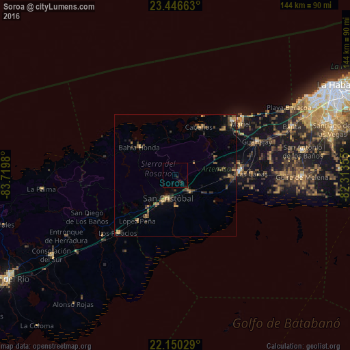
Analysis of Soroa night lights 2016
Square area 10x10 km:
 0%
0%90-99
0%80-89
0%70-79
0%60-69
0%50-59
0%40-49
0%30-39
1.39%20-29
0.99%10-19
2.38%0-9
95.24%Square area 50x50 km:
0.03%90-99
0.04%80-89
0.41%70-79
0.77%60-69
0.47%50-59
0.56%40-49
1.24%30-39
1.02%20-29
0.88%10-19
1.65%0-9
92.94%Clear (daylight) street map image can be seen on geolist.org.
Map coordinates:
23° 26' 47.9" North, 83° 43' 11.3" West
22° 48' 0" North, 83° 1' 0" West
22° 9' 1" North, 82° 18' 48.8" West
Some cities around Soroa sort by population:
• Artemisa
26.4 km =16.4 mi,  85°
85°
• San Cristobal
10.1 km =6.3 mi,  203°
203°
• Mariel
34.2 km =21.3 mi,  51°
51°
• Los Palacios
33.3 km =20.7 mi,  225°
225°
• Guanajay
36.5 km =22.7 mi,  67°
67°
• Bahía Honda
18.6 km =11.6 mi,  308°
308°
• Candelaria
8.9 km =5.5 mi,  138°
138°
• Cabañas
22.2 km =13.8 mi,  25°
25°
3535775 (p: 7,205)
Sources (retrieved 2019-11-25):
» Earth at Night: Flat Maps 2012, 2016