Bahía Honda night lights from space
Night Light of Bahía Honda (Artemisa) from space (Cuba) Src. Average luminocity for 10x10km area is 5.4583% and for 50x50km: 1.4447%.
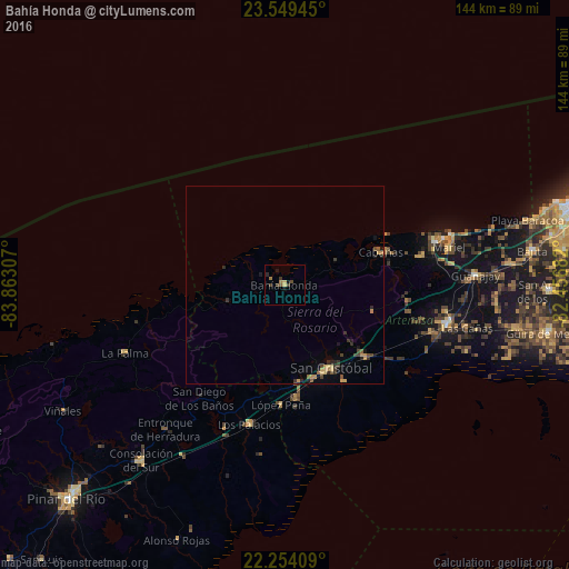
Analysis of Bahía Honda night lights 2016
Square area 10x10 km:
 0%
0%90-99
0%80-89
0.79%70-79
0.79%60-69
1.59%50-59
0.79%40-49
0.79%30-39
3.17%20-29
0.79%10-19
2.38%0-9
88.89%Square area 50x50 km:
0%90-99
0%80-89
0.21%70-79
0.41%60-69
0.17%50-59
0.19%40-49
0.32%30-39
0.42%20-29
0.49%10-19
0.44%0-9
97.35%Clear (daylight) street map image can be seen on geolist.org.
Map coordinates:
23° 32' 58" North, 83° 51' 47.1" West
22° 54' 12" North, 83° 9' 35.8" West
22° 15' 14.7" North, 82° 27' 24.6" West
Some cities around Bahía Honda sort by population:
• Artemisa
42.1 km =26.2 mi,  103°
103°
• San Cristobal
23.3 km =14.5 mi,  152°
152°
• Mariel
42.7 km =26.5 mi,  77°
77°
• Los Palacios
36.1 km =22.4 mi,  194°
194°
• Guanajay
48.5 km =30.1 mi,  86°
86°
• Candelaria
27.4 km =17 mi,  131°
131°
• Soroa
18.6 km =11.6 mi, 128°
• Cabañas
25.8 km =16 mi,  70°
70°
3567995 (p: 19,834)
Sources (retrieved 2019-11-25):
» Earth at Night: Flat Maps 2012, 2016