Río Guayabal de Yateras night lights from space
Night Light of Río Guayabal de Yateras (Guantánamo) from space (Cuba) Src. Average luminocity for 10x10km area is 0.3788% and for 50x50km: 1.9812%.
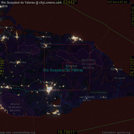
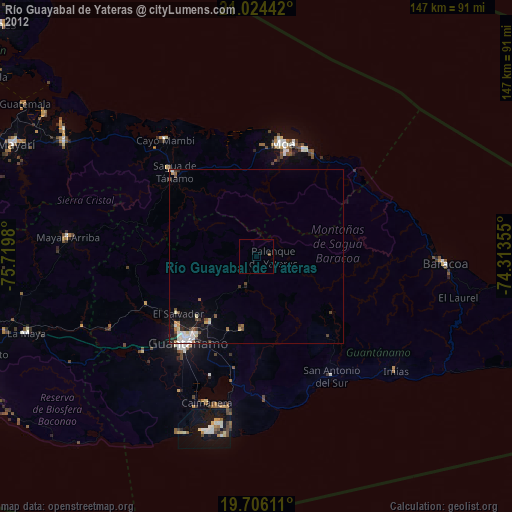
Analysis of Río Guayabal de Yateras night lights 2016
Square area 10x10 km:
 0%
0%90-99
0%80-89
0%70-79
0%60-69
0%50-59
0%40-49
0.76%30-39
0%20-29
0%10-19
0%0-9
99.24%Square area 50x50 km:
0.16%90-99
0.4%80-89
0.43%70-79
0.14%60-69
0.19%50-59
0.22%40-49
0.28%30-39
0.26%20-29
0.53%10-19
1.52%0-9
95.87%Clear (daylight) street map image can be seen on geolist.org.
Map coordinates:
21° 1' 27.9" North, 75° 43' 11.3" West
20° 22' 0" North, 75° 1' 0" West
19° 42' 22" North, 74° 18' 48.8" West
Some cities around Río Guayabal de Yateras sort by population:
• Santiago de Cuba
92.9 km =57.7 mi,  245°
245°
• Guantánamo
31.8 km =19.8 mi,  219°
219°
• Moa
33.1 km =20.6 mi,  11°
11°
• San Luis
89.2 km =55.4 mi,  257°
257°
• Banes
98.8 km =61.4 mi,  312°
312°
• Baracoa
54.3 km =33.7 mi,  92°
92°
• Maisí
91.2 km =56.7 mi,  98°
98°
• Sagua de Tánamo
33.5 km =20.8 mi,  315°
315°
3542137 (p: 25,753)
Sources (retrieved 2019-11-25):
» Earth at Night: Flat Maps 2012, 2016