Baracoa night lights from space
Night Light of Baracoa (Guantánamo) from space (Cuba) Src. Average luminocity for 10x10km area is 3.9545% and for 50x50km: 0.1672%.
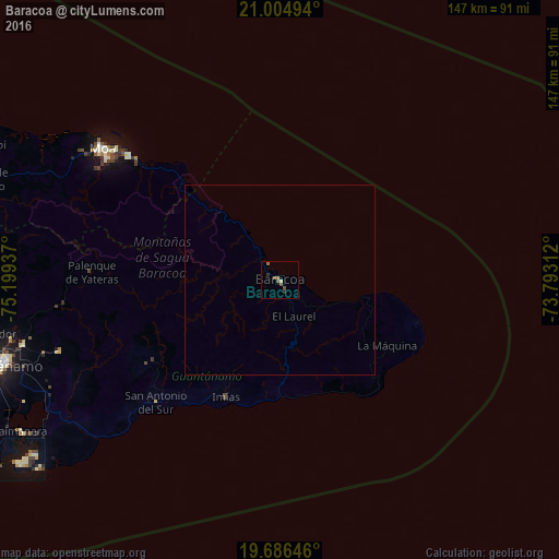
Analysis of Baracoa night lights 2016
Square area 10x10 km:
 0%
0%90-99
0%80-89
0.76%70-79
0.19%60-69
1.33%50-59
2.08%40-49
0.95%30-39
0%20-29
1.52%10-19
0%0-9
93.18%Square area 50x50 km:
0%90-99
0%80-89
0.03%70-79
0.01%60-69
0.06%50-59
0.09%40-49
0.04%30-39
0%20-29
0.06%10-19
0%0-9
99.71%Clear (daylight) street map image can be seen on geolist.org.
Map coordinates:
21° 0' 17.8" North, 75° 11' 57.7" West
20° 20' 49.6" North, 74° 29' 46.5" West
19° 41' 11.3" North, 73° 47' 35.2" West
Some cities around Baracoa sort by population:
• Santiago de Cuba
143.5 km =89.2 mi,  255°
255°
• Guantánamo
77.7 km =48.3 mi,  253°
253°
• Moa
58.6 km =36.4 mi,  306°
306°
• San Luis
142.3 km =88.4 mi, 262°
• Maisí
37.6 km =23.4 mi,  107°
107°
• Río Guayabal de Yateras
54.3 km =33.7 mi,  272°
272°
• Sagua de Tánamo
81.9 km =50.9 mi,  288°
288°
• Matthew Town, BS
108.7 km =67.5 mi,  51°
51°
3567834 (p: 48,362)
Sources (retrieved 2019-11-25):
» Earth at Night: Flat Maps 2012, 2016