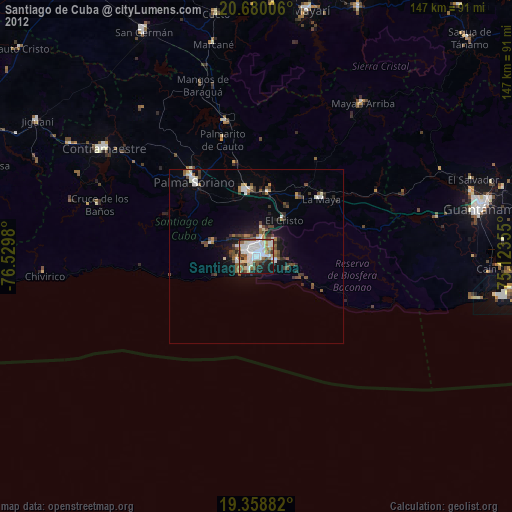
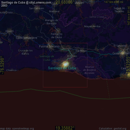
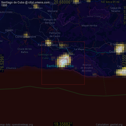
Santiago de Cuba night lights from space
Night Light of Santiago de Cuba from space (Cuba) Src. Average luminocity for 10x10km area is 80.2917% and for 50x50km: 11.5971%.

Analysis of Santiago de Cuba night lights 2016
Square area 10x10 km:
 22.02%
90-99
28.97%80-89
16.87%70-79
7.14%60-69
2.18%50-59
7.14%40-49
4.96%30-39
6.15%20-29
4.56%10-19
0%0-9
0%Square area 50x50 km:
1.34%90-99
2.2%80-89
1.91%70-79
1.2%60-69
1.07%50-59
1.12%40-49
1.85%30-39
1.78%20-29
2.94%10-19
8.44%0-9
76.14%Clear (daylight) street map image can be seen on geolist.org.
Map coordinates:
20° 40' 48.2" North, 76° 31' 47.3" West
20° 1' 15" North, 75° 49' 36" West
19° 21' 31.8" North, 75° 7' 24.8" West
Some cities around Santiago de Cuba sort by population:
• Guantánamo
65.9 km =40.9 mi,  77°
77°
• Palma Soriano
27.4 km =17 mi,  320°
320°
• Contramaestre
53.5 km =33.2 mi,  305°
305°
• San Luis
18.8 km =11.7 mi,  352°
352°
• San Germán
71.9 km =44.7 mi,  333°
333°
• Jiguaní
73.6 km =45.7 mi,  301°
301°
• Cueto
70.6 km =43.9 mi, 351°
• Guisa
78.8 km =49 mi,  289°
289°
3536729 (p: 555,865)
Sources (retrieved 2019-11-25):
» NASA, Earths city lights 1995
» NASA city lights 2003
» Earth at Night: Flat Maps 2012, 2016