Guantánamo night lights from space
Night Light of Guantánamo from space (Cuba) Src. Average luminocity for 10x10km area is 42.7877% and for 50x50km: 3.5055%.
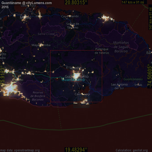
Analysis of Guantánamo night lights 2016
Square area 10x10 km:
 6.75%
6.75%90-99
11.71%80-89
10.52%70-79
2.18%60-69
0.99%50-59
2.98%40-49
4.17%30-39
4.37%20-29
11.31%10-19
38.49%0-9
6.55%Square area 50x50 km:
0.27%90-99
0.62%80-89
0.73%70-79
0.22%60-69
0.24%50-59
0.35%40-49
0.54%30-39
0.5%20-29
0.82%10-19
3.05%0-9
92.66%Clear (daylight) street map image can be seen on geolist.org.
Map coordinates:
20° 48' 11.3" North, 75° 54' 44.3" West
20° 8' 40" North, 75° 12' 33" West
19° 28' 58.6" North, 74° 30' 21.8" West
Some cities around Guantánamo sort by population:
• Santiago de Cuba
65.9 km =40.9 mi,  257°
257°
• Palma Soriano
82.2 km =51.1 mi,  275°
275°
• Moa
63.1 km =39.2 mi,  25°
25°
• San Luis
67.1 km =41.7 mi,  274°
274°
• Baracoa
77.7 km =48.3 mi,  73°
73°
• Cueto
93.7 km =58.2 mi,  306°
306°
• Río Guayabal de Yateras
31.8 km =19.8 mi,  39°
39°
• Sagua de Tánamo
48.8 km =30.3 mi,  356°
356°
3557689 (p: 272,801)
Sources (retrieved 2019-11-25):
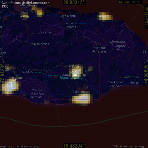
» NASA, Earths city lights 1995
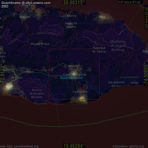
» NASA city lights 2003
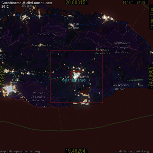
» Earth at Night: Flat Maps 2012, 2016