San Luis night lights from space
Night Light of San Luis (Santiago de Cuba) from space (Cuba) Src. Average luminocity for 10x10km area is 21.3869% and for 50x50km: 11.763%.
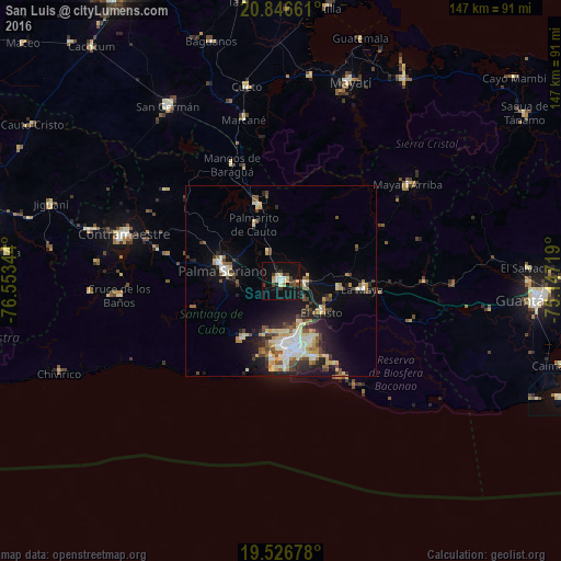
Analysis of San Luis night lights 2016
Square area 10x10 km:
 2.58%
2.58%90-99
2.78%80-89
3.37%70-79
3.17%60-69
0%50-59
0.2%40-49
4.17%30-39
6.55%20-29
1.59%10-19
29.56%0-9
46.03%Square area 50x50 km:
1.33%90-99
2.27%80-89
1.98%70-79
1.19%60-69
1.03%50-59
1.23%40-49
2%30-39
1.8%20-29
2.91%10-19
8.06%0-9
76.21%Clear (daylight) street map image can be seen on geolist.org.
Map coordinates:
20° 50' 47.8" North, 76° 33' 12.4" West
20° 11' 17.1" North, 75° 51' 1.1" West
19° 31' 36.4" North, 75° 8' 49.9" West
Some cities around San Luis sort by population:
• Santiago de Cuba
18.8 km =11.7 mi,  172°
172°
• Guantánamo
67.1 km =41.7 mi,  94°
94°
• Palma Soriano
15.2 km =9.4 mi,  279°
279°
• Contramaestre
43 km =26.7 mi,  286°
286°
• San Germán
54.5 km =33.9 mi,  327°
327°
• Jiguaní
63.4 km =39.4 mi, 288°
• Cueto
51.9 km =32.2 mi,  350°
350°
• Guisa
72.3 km =44.9 mi, 275°
3539093 (p: 67,293)
Sources (retrieved 2019-11-25):
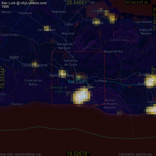
» NASA, Earths city lights 1995
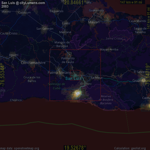
» NASA city lights 2003
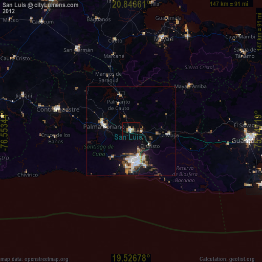
» Earth at Night: Flat Maps 2012, 2016