Jovellanos night lights from space
Night Light of Jovellanos (Matanzas) from space (Cuba) Src. Average luminocity for 10x10km area is 10.5516% and for 50x50km: 2.1613%.
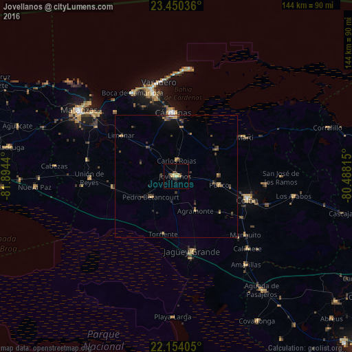
Analysis of Jovellanos night lights 2016
Square area 10x10 km:
 0%
0%90-99
1.19%80-89
3.17%70-79
1.98%60-69
0.79%50-59
2.18%40-49
0.6%30-39
1.79%20-29
0.79%10-19
0.99%0-9
86.51%Square area 50x50 km:
0.02%90-99
0.08%80-89
0.31%70-79
0.33%60-69
0.43%50-59
0.31%40-49
0.63%30-39
0.58%20-29
0.43%10-19
0.82%0-9
96.06%Clear (daylight) street map image can be seen on geolist.org.
Map coordinates:
23° 27' 1.3" North, 81° 53' 39.8" West
22° 48' 13.5" North, 81° 11' 28.6" West
22° 9' 14.6" North, 80° 29' 17.3" West
Some cities around Jovellanos sort by population:
• Cárdenas
25.9 km =16.1 mi,  356°
356°
• Colón
30.8 km =19.1 mi,  107°
107°
• Jagüey Grande
31.4 km =19.5 mi,  168°
168°
• Pedro Betancourt
13.2 km =8.2 mi,  229°
229°
• Limonar
27.8 km =17.3 mi,  305°
305°
• Perico
18.1 km =11.2 mi,  101°
101°
• Martí
32.1 km =19.9 mi,  60°
60°
• Bolondrón
26.7 km =16.6 mi,  260°
260°
3555907 (p: 47,164)
Sources (retrieved 2019-11-25):
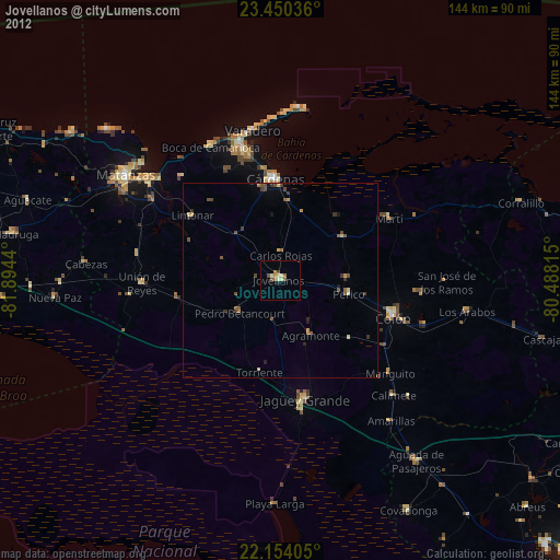
» Earth at Night: Flat Maps 2012, 2016