Pedro Betancourt night lights from space
Night Light of Pedro Betancourt (Matanzas) from space (Cuba) Src. Average luminocity for 10x10km area is 3.4504% and for 50x50km: 1.5169%.
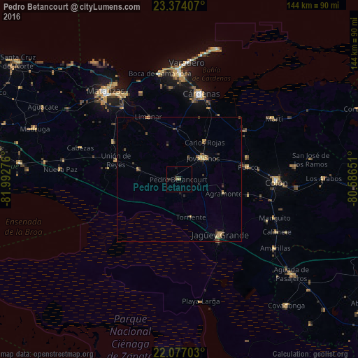
Analysis of Pedro Betancourt night lights 2016
Square area 10x10 km:
 0%
0%90-99
0%80-89
0.79%70-79
0%60-69
0.4%50-59
0.4%40-49
1.79%30-39
1.59%20-29
1.39%10-19
0.79%0-9
92.86%Square area 50x50 km:
0%90-99
0.05%80-89
0.38%70-79
0.23%60-69
0.16%50-59
0.17%40-49
0.5%30-39
0.44%20-29
0.32%10-19
0.33%0-9
97.42%Clear (daylight) street map image can be seen on geolist.org.
Map coordinates:
23° 22' 26.7" North, 81° 59' 33.9" West
22° 43' 37.5" North, 81° 17' 22.7" West
22° 4' 37.3" North, 80° 35' 11.4" West
Some cities around Pedro Betancourt sort by population:
• Cárdenas
35.5 km =22.1 mi,  13°
13°
• Jagüey Grande
27.7 km =17.2 mi,  143°
143°
• Jovellanos
13.2 km =8.2 mi,  49°
49°
• Unión de Reyes
26.4 km =16.4 mi,  286°
286°
• Limonar
27.7 km =17.2 mi,  333°
333°
• Perico
28.2 km =17.5 mi,  80°
80°
• Bolondrón
16.7 km =10.4 mi,  283°
283°
• Alacranes
28.9 km =18 mi, 278°
3544607 (p: 26,761)
Sources (retrieved 2019-11-25):
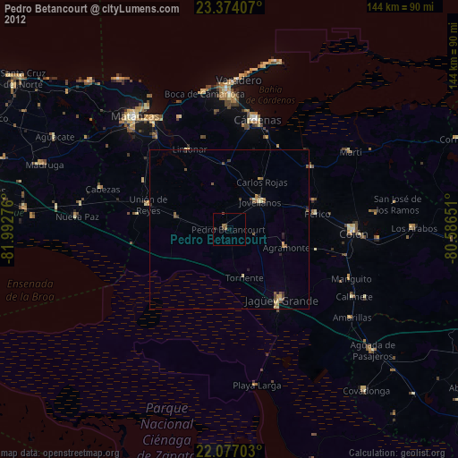
» Earth at Night: Flat Maps 2012, 2016