Palma Soriano night lights from space
Night Light of Palma Soriano (Santiago de Cuba) from space (Cuba) Src. Average luminocity for 10x10km area is 24.6429% and for 50x50km: 10.0047%.
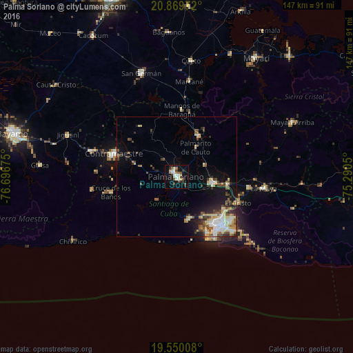
Analysis of Palma Soriano night lights 2016
Square area 10x10 km:
 2.98%
2.98%90-99
6.94%80-89
1.98%70-79
1.19%60-69
1.98%50-59
3.77%40-49
2.98%30-39
5.36%20-29
1.19%10-19
22.42%0-9
49.21%Square area 50x50 km:
1.27%90-99
2.07%80-89
1.69%70-79
0.92%60-69
0.74%50-59
1.25%40-49
1.74%30-39
1.66%20-29
1.83%10-19
5.83%0-9
80.99%Clear (daylight) street map image can be seen on geolist.org.
Map coordinates:
20° 52' 11" North, 76° 41' 48.3" West
20° 12' 40.7" North, 75° 59' 37" West
19° 33' 0.3" North, 75° 17' 25.8" West
Some cities around Palma Soriano sort by population:
• Santiago de Cuba
27.4 km =17 mi,  140°
140°
• Contramaestre
28 km =17.4 mi,  290°
290°
• San Luis
15.2 km =9.4 mi,  99°
99°
• San Germán
45.6 km =28.3 mi,  341°
341°
• Jiguaní
48.5 km =30.1 mi, 291°
• Cueto
49.1 km =30.5 mi,  7°
7°
• Cauto Cristo
63 km =39.1 mi,  307°
307°
• Guisa
57.1 km =35.5 mi,  274°
274°
3545064 (p: 102,826)
Sources (retrieved 2019-11-25):
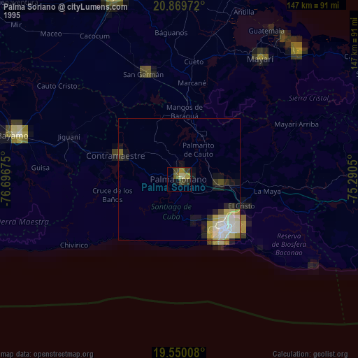
» NASA, Earths city lights 1995
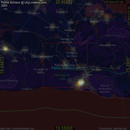
» NASA city lights 2003
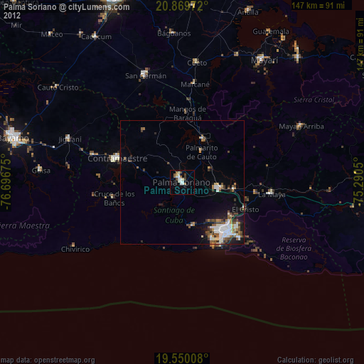
» Earth at Night: Flat Maps 2012, 2016