San Vicente night lights from space
Night Light of San Vicente (San José) from space (Costa Rica) Src. Average luminocity for 10x10km area is 93.0289% and for 50x50km: 28.9344%.

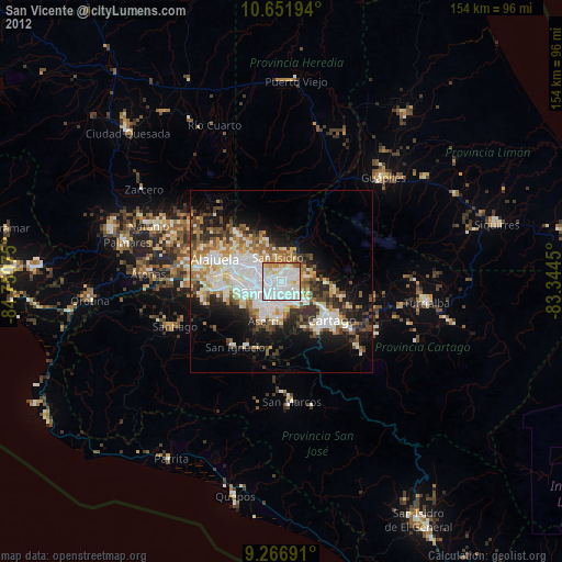
Analysis of San Vicente night lights 2016
Square area 10x10 km:
 53.1%
53.1%90-99
23.14%80-89
8.06%70-79
7.02%60-69
6.4%50-59
1.45%40-49
0.83%30-39
0%20-29
0%10-19
0%0-9
0%Square area 50x50 km:
7.85%90-99
6.04%80-89
2.69%70-79
2.61%60-69
3.96%50-59
3.68%40-49
3.76%30-39
4.2%20-29
5.65%10-19
9.28%0-9
50.26%Clear (daylight) street map image can be seen on geolist.org.
Map coordinates:
10° 39' 7" North, 84° 45' 2.7" West
9° 57' 36.6" North, 84° 2' 51.4" West
9° 16' 0.9" North, 83° 20' 40.2" West
Some cities around San Vicente sort by population:
• Purral
1.9 km =1.2 mi,  97°
97°
• San Pedro
3.6 km =2.2 mi,  185°
185°
• Ipís
3.8 km =2.4 mi,  77°
77°
• San Juan
3.7 km =2.3 mi,  269°
269°
• Guadalupe
1.7 km =1.1 mi,  216°
216°
• Calle Blancos
2.4 km =1.5 mi,  241°
241°
• Colima
4.2 km =2.6 mi,  255°
255°
• Sabanilla
1.9 km =1.2 mi,  151°
151°
3621505 (p: 34,447)
Sources (retrieved 2019-11-25):
» Earth at Night: Flat Maps 2012, 2016