San Pedro night lights from space
Night Light of San Pedro (San José) from space (Costa Rica) Src. Average luminocity for 10x10km area is 96.8264% and for 50x50km: 29.1174%.
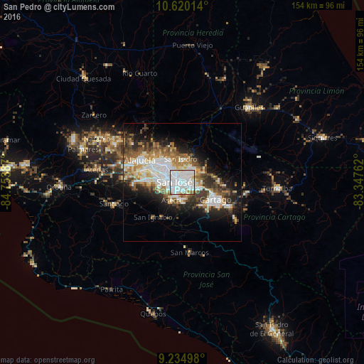
Analysis of San Pedro night lights 2016
Square area 10x10 km:
 65.91%
90-99
23.97%80-89
4.13%70-79
1.45%60-69
3.93%50-59
0.62%40-49
0%30-39
0%20-29
0%10-19
0%0-9
0%Square area 50x50 km:
7.87%90-99
6.08%80-89
2.71%70-79
2.63%60-69
4.07%50-59
3.71%40-49
3.83%30-39
4.25%20-29
5.66%10-19
9.25%0-9
49.94%Clear (daylight) street map image can be seen on geolist.org.
Map coordinates:
10° 37' 12.5" North, 84° 45' 13.9" West
9° 55' 41.8" North, 84° 3' 2.7" West
9° 14' 5.9" North, 83° 20' 51.4" West
Some cities around San Pedro sort by population:
• San José
3.6 km =2.2 mi,  278°
278°
• Curridabat
2.6 km =1.6 mi,  135°
135°
• San Vicente de Moravia
3.7 km =2.3 mi,  3°
3°
• San Vicente
3.6 km =2.2 mi,  5°
5°
• Guadalupe
2.3 km =1.4 mi,  343°
343°
• Calle Blancos
3 km =1.9 mi,  324°
324°
• Sabanilla
2.3 km =1.4 mi,  33°
33°
• Granadilla
3.8 km =2.4 mi,  78°
78°
3621717 (p: 27,477)
Sources (retrieved 2019-11-25):
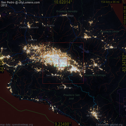
» Earth at Night: Flat Maps 2012, 2016