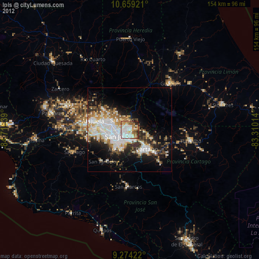
Ipís night lights from space
Night Light of Ipís (San José) from space (Costa Rica) Src. Average luminocity for 10x10km area is 78.6942% and for 50x50km: 27.4202%.
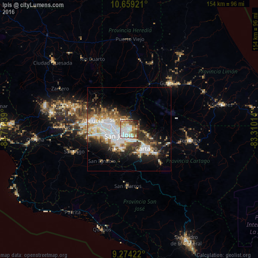
Analysis of Ipís night lights 2016
Square area 10x10 km:
 27.48%
90-99
20.87%80-89
8.47%70-79
9.71%60-69
9.71%50-59
7.23%40-49
9.3%30-39
1.86%20-29
4.13%10-19
1.24%0-9
0%Square area 50x50 km:
7.68%90-99
5.88%80-89
2.53%70-79
2.47%60-69
3.53%50-59
3.21%40-49
3.35%30-39
3.76%20-29
5.34%10-19
8.95%0-9
53.32%Clear (daylight) street map image can be seen on geolist.org.
Map coordinates:
10° 39' 33.2" North, 84° 42' 59" West
9° 58' 2.8" North, 84° 0' 47.7" West
9° 16' 27.2" North, 83° 18' 36.5" West
Some cities around Ipís sort by population:
• San Vicente de Moravia
3.9 km =2.4 mi,  260°
260°
• San Vicente
3.8 km =2.4 mi, 257°
• Purral
2.2 km =1.4 mi,  241°
241°
• San Pedro
6 km =3.7 mi,  223°
223°
• Guadalupe
5.2 km =3.2 mi,  245°
245°
• Concepción
4.1 km =2.5 mi,  159°
159°
• Sabanilla
3.8 km =2.4 mi,  229°
229°
• Granadilla
3.6 km =2.2 mi,  186°
186°
3623394 (p: 26,669)
Sources (retrieved 2019-11-25):
» Earth at Night: Flat Maps 2012, 2016