Purral night lights from space
Night Light of Purral (San José) from space (Costa Rica) Src. Average luminocity for 10x10km area is 88.5145% and for 50x50km: 28.2758%.
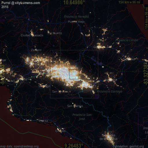
Analysis of Purral night lights 2016
Square area 10x10 km:
 41.53%
90-99
23.76%80-89
7.85%70-79
9.5%60-69
10.12%50-59
3.31%40-49
3.51%30-39
0%20-29
0.41%10-19
0%0-9
0%Square area 50x50 km:
7.82%90-99
5.95%80-89
2.58%70-79
2.56%60-69
3.82%50-59
3.47%40-49
3.59%30-39
3.94%20-29
5.48%10-19
9.1%0-9
51.68%Clear (daylight) street map image can be seen on geolist.org.
Map coordinates:
10° 38' 59.5" North, 84° 44' 1.1" West
9° 57' 29.1" North, 84° 1' 49.8" West
9° 15' 53.4" North, 83° 19' 38.6" West
Some cities around Purral sort by population:
• San Vicente de Moravia
2 km =1.2 mi,  281°
281°
• San Vicente
1.9 km =1.2 mi, 277°
• San Pedro
4 km =2.5 mi,  213°
213°
• Ipís
2.2 km =1.4 mi,  61°
61°
• Guadalupe
3.1 km =1.9 mi,  248°
248°
• Calle Blancos
4.1 km =2.5 mi,  257°
257°
• Sabanilla
1.7 km =1.1 mi, 213°
• Granadilla
3 km =1.9 mi,  149°
149°
3622217 (p: 30,034)
Sources (retrieved 2019-11-25):
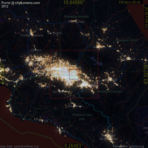
» Earth at Night: Flat Maps 2012, 2016