San Juan night lights from space
Night Light of San Juan (San José) from space (Costa Rica) Src. Average luminocity for 10x10km area is 95.7252% and for 50x50km: 30.178%.
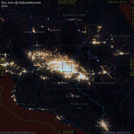
Analysis of San Juan night lights 2016
Square area 10x10 km:
 68.8%
68.8%90-99
15.08%80-89
5.79%70-79
5.79%60-69
4.55%50-59
0%40-49
0%30-39
0%20-29
0%10-19
0%0-9
0%Square area 50x50 km:
7.89%90-99
6.19%80-89
2.86%70-79
2.68%60-69
4.27%50-59
4.11%40-49
4.32%30-39
4.6%20-29
6.08%10-19
8.92%0-9
48.1%Clear (daylight) street map image can be seen on geolist.org.
Map coordinates:
10° 39' 5.5" North, 84° 47' 5.2" West
9° 57' 35.1" North, 84° 4' 53.9" West
9° 15' 59.4" North, 83° 22' 42.7" West
Some cities around San Juan sort by population:
• San Vicente
3.7 km =2.3 mi,  89°
89°
• San Vicente de Moravia
3.6 km =2.2 mi, 86°
• San Pedro
4.9 km =3 mi,  135°
135°
• Guadalupe
3 km =1.9 mi,  115°
115°
• San Pablo
4.3 km =2.7 mi,  337°
337°
• Calle Blancos
2 km =1.2 mi, 123°
• Colima
1 km =0.6 mi,  200°
200°
• Sabanilla
4.9 km =3 mi,  109°
109°
3621819 (p: 26,047)
Sources (retrieved 2019-11-25):
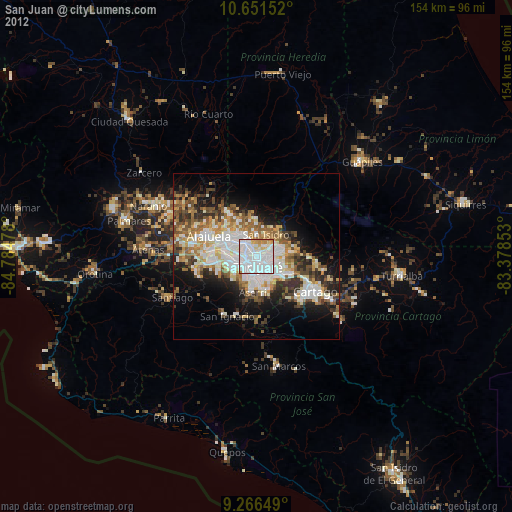
» Earth at Night: Flat Maps 2012, 2016