San José night lights from space
Night Light of San José from space (Costa Rica) Src. Average luminocity for 10x10km area is 97.1281% and for 50x50km: 30.2702%.
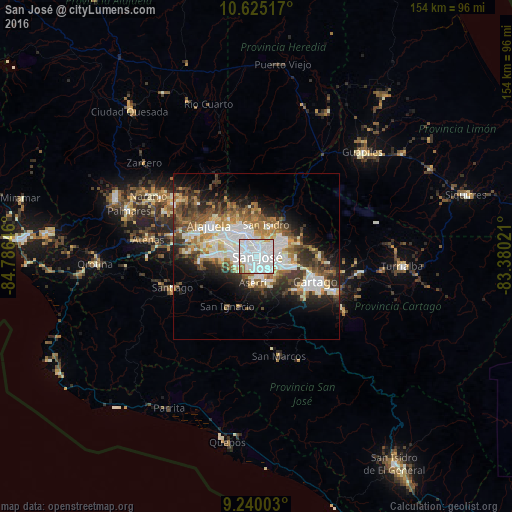

Analysis of San José night lights 2016
Square area 10x10 km:
 73.35%
90-99
17.77%80-89
3.72%70-79
0.41%60-69
3.93%50-59
0.83%40-49
0%30-39
0%20-29
0%10-19
0%0-9
0%Square area 50x50 km:
7.9%90-99
6.17%80-89
2.86%70-79
2.69%60-69
4.33%50-59
4.14%40-49
4.32%30-39
4.63%20-29
6.17%10-19
8.87%0-9
47.92%Clear (daylight) street map image can be seen on geolist.org.
Map coordinates:
10° 37' 30.6" North, 84° 47' 11.3" West
9° 55' 60" North, 84° 4' 60" West
9° 14' 24.1" North, 83° 22' 48.8" West
Some cities around San José sort by population:
• San Vicente
4.9 km =3 mi,  52°
52°
• San Vicente de Moravia
4.9 km =3 mi, 50°
• San Pedro
3.6 km =2.2 mi,  98°
98°
• Guadalupe
3.3 km =2.1 mi,  60°
60°
• San Felipe
4 km =2.5 mi,  217°
217°
• Calle Blancos
2.6 km =1.6 mi,  44°
44°
• Colima
2 km =1.2 mi,  354°
354°
• Alajuelita
4 km =2.5 mi,  207°
207°
3621849 (p: 335,007)
Sources (retrieved 2019-11-25):
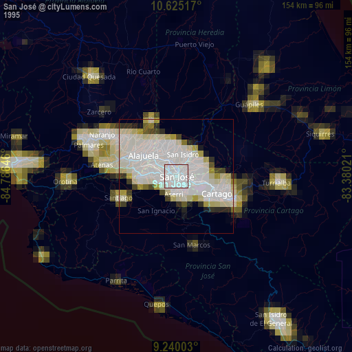
» NASA, Earths city lights 1995
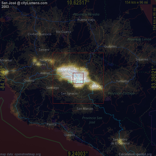
» NASA city lights 2003
» Earth at Night: Flat Maps 2012, 2016