Paipa night lights from space
Night Light of Paipa (Boyacá) from space (Colombia) Src. Average luminocity for 10x10km area is 22.593% and for 50x50km: 6.9703%.
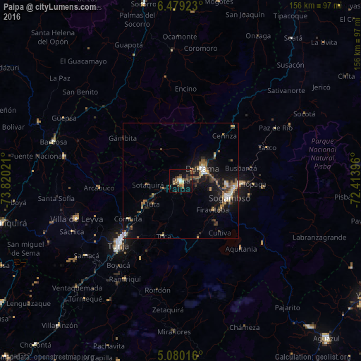
Analysis of Paipa night lights 2016
Square area 10x10 km:
 1.03%
1.03%90-99
2.27%80-89
1.45%70-79
1.65%60-69
5.58%50-59
8.26%40-49
2.48%30-39
5.17%20-29
1.65%10-19
23.76%0-9
46.69%Square area 50x50 km:
0.74%90-99
0.68%80-89
0.59%70-79
0.71%60-69
1.45%50-59
1.32%40-49
0.84%30-39
1.54%20-29
1.28%10-19
7.03%0-9
83.82%Clear (daylight) street map image can be seen on geolist.org.
Map coordinates:
6° 28' 45.2" North, 73° 49' 12.8" West
5° 46' 48.5" North, 73° 7' 1.5" West
5° 4' 48.6" North, 72° 24' 50.3" West
Some cities around Paipa sort by population:
• Sogamoso
21.5 km =13.4 mi,  109°
109°
• Tunja
38.9 km =24.2 mi,  225°
225°
• Duitama
10.4 km =6.5 mi,  61°
61°
• Santa Rosa de Viterbo
18.2 km =11.3 mi, 55°
• Aquitania
38.9 km =24.2 mi,  138°
138°
• Belén
32.4 km =20.1 mi,  44°
44°
• Pesca
26.6 km =16.5 mi,  163°
163°
• Villa de Leyva
47.9 km =29.8 mi,  250°
250°
3673369 (p: 13,554)
Sources (retrieved 2019-11-25):
» Earth at Night: Flat Maps 2012, 2016