Maní night lights from space
Night Light of Maní (Casanare) from space (Colombia) Src. Average luminocity for 10x10km area is 5.5909% and for 50x50km: 0.438%.
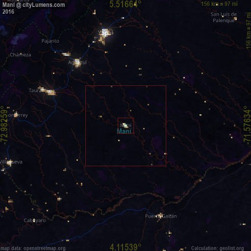
Analysis of Maní night lights 2016
Square area 10x10 km:
 0.62%
0.62%90-99
0.41%80-89
2.27%70-79
0.62%60-69
0.21%50-59
0.83%40-49
0.83%30-39
0.83%20-29
0%10-19
0%0-9
93.39%Square area 50x50 km:
0.03%90-99
0.02%80-89
0.13%70-79
0.06%60-69
0.04%50-59
0.1%40-49
0.07%30-39
0.14%20-29
0.06%10-19
0.04%0-9
99.31%Clear (daylight) street map image can be seen on geolist.org.
Map coordinates:
5° 30' 59.9" North, 72° 58' 57.3" West
4° 48' 59" North, 72° 16' 46.1" West
4° 6' 55.4" North, 71° 34' 34.8" West
Some cities around Maní sort by population:
• Yopal
59.4 km =36.9 mi,  347°
347°
• Villanueva
62.4 km =38.8 mi,  33°
33°
• Puerto López
109.5 km =68 mi,  223°
223°
• Aguazul
49.5 km =30.8 mi,  323°
323°
• Monterrey
68.6 km =42.6 mi,  275°
275°
• Puerto Gaitán
60.1 km =37.3 mi,  158°
158°
• Aquitania
102.8 km =63.9 mi, 319°
• Pesca
118 km =73.3 mi,  313°
313°
3675452 (p: 7,031)
Sources (retrieved 2019-11-25):
» Earth at Night: Flat Maps 2012, 2016