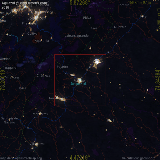
Aguazul night lights from space
Night Light of Aguazul (Casanare) from space (Colombia) Src. Average luminocity for 10x10km area is 18.2417% and for 50x50km: 4.0015%.
Analysis of Aguazul night lights 2016
Square area 10x10 km:
 3.1%
3.1%90-99
1.86%80-89
3.31%70-79
0%60-69
2.69%50-59
1.45%40-49
2.48%30-39
5.17%20-29
2.48%10-19
5.99%0-9
71.49%Square area 50x50 km:
0.63%90-99
0.45%80-89
0.57%70-79
0.31%60-69
0.41%50-59
0.45%40-49
0.45%30-39
0.83%20-29
0.51%10-19
2.51%0-9
92.88%Clear (daylight) street map image can be seen on geolist.org.
Map coordinates:
5° 52' 21.6" North, 73° 15' 0.7" West
5° 10' 22.2" North, 72° 32' 49.4" West
4° 28' 19.9" North, 71° 50' 38.2" West
Some cities around Aguazul sort by population:
• Sogamoso
73.9 km =45.9 mi,  324°
324°
• Duitama
90.3 km =56.1 mi, 323°
• Yopal
24.8 km =15.4 mi,  42°
42°
• Villanueva
65.4 km =40.6 mi,  79°
79°
• Monterrey
50.7 km =31.5 mi,  229°
229°
• Maní
49.5 km =30.8 mi,  143°
143°
• Aquitania
53.6 km =33.3 mi, 315°
• Pesca
69.7 km =43.3 mi,  306°
306°
3690316 (p: 15,669)
Sources (retrieved 2019-11-25):
» Earth at Night: Flat Maps 2012, 2016