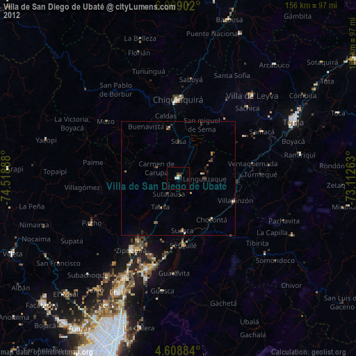
Villa de San Diego de Ubaté night lights from space
Night Light of Villa de San Diego de Ubaté (Cundinamarca) from space (Colombia) Src. Average luminocity for 10x10km area is 6.6467% and for 50x50km: 1.6597%.
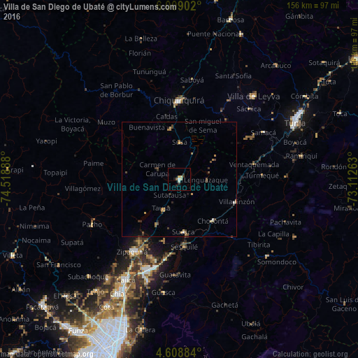
Analysis of Villa de San Diego de Ubaté night lights 2016
Square area 10x10 km:
 0.62%
0.62%90-99
1.03%80-89
1.86%70-79
0.62%60-69
0%50-59
0.83%40-49
0.41%30-39
2.69%20-29
0.21%10-19
1.65%0-9
90.08%Square area 50x50 km:
0.08%90-99
0.09%80-89
0.29%70-79
0.21%60-69
0.3%50-59
0.3%40-49
0.31%30-39
0.57%20-29
0.13%10-19
0.31%0-9
97.41%Clear (daylight) street map image can be seen on geolist.org.
Map coordinates:
6° 0' 32.5" North, 74° 31' 8" West
5° 18' 33.6" North, 73° 48' 56.7" West
4° 36' 31.8" North, 73° 6' 45.5" West
Some cities around Villa de San Diego de Ubaté sort by population:
• Zipaquirá
38.2 km =23.7 mi,  213°
213°
• Chiquinquirá
34.1 km =21.2 mi,  359°
359°
• La Mesa
12.1 km =7.5 mi,  246°
246°
• Pacho
42.9 km =26.7 mi,  242°
242°
• Muzo
40.9 km =25.4 mi,  307°
307°
• Chocontá
23.3 km =14.5 mi,  141°
141°
• Tocancipá
39.7 km =24.7 mi,  195°
195°
• Nemocón
27.7 km =17.2 mi,  194°
194°
3666519 (p: 20,485)
Sources (retrieved 2019-11-25):
» Earth at Night: Flat Maps 2012, 2016