Copacabana night lights from space
Night Light of Copacabana (Antioquia) from space (Colombia) Src. Average luminocity for 10x10km area is 58.1169% and for 50x50km: 25.5984%.
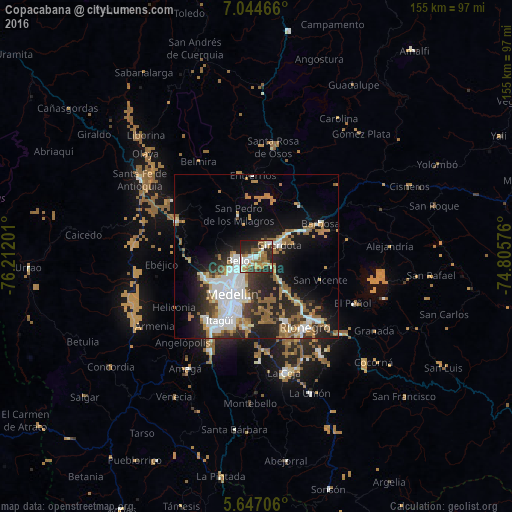
Analysis of Copacabana night lights 2016
Square area 10x10 km:
 8.23%
8.23%90-99
16.23%80-89
4.98%70-79
8.44%60-69
13.64%50-59
6.93%40-49
2.38%30-39
9.31%20-29
23.59%10-19
6.28%0-9
0%Square area 50x50 km:
6.04%90-99
4.48%80-89
1.77%70-79
2.98%60-69
4.21%50-59
4.43%40-49
1.04%30-39
3.02%20-29
8.34%10-19
11.41%0-9
52.28%Clear (daylight) street map image can be seen on geolist.org.
Map coordinates:
7° 2' 40.8" North, 76° 12' 43.2" West
6° 20' 46.8" North, 75° 30' 32" West
5° 38' 49.4" North, 74° 48' 20.7" West
Some cities around Copacabana sort by population:
• Medellín
12.1 km =7.5 mi,  209°
209°
• Bello
5.5 km =3.4 mi,  259°
259°
• Itagüí
20.6 km =12.8 mi, 209°
• Envigado
21 km =13 mi, 205°
• Guarne
10.3 km =6.4 mi,  135°
135°
• Donmatías
20 km =12.4 mi,  39°
39°
• San Pedro
13.9 km =8.6 mi,  337°
337°
• San Vicente
20.5 km =12.7 mi,  109°
109°
3685949 (p: 49,169)
Sources (retrieved 2019-11-25):
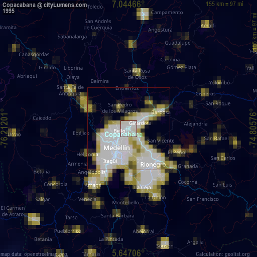
» NASA, Earths city lights 1995
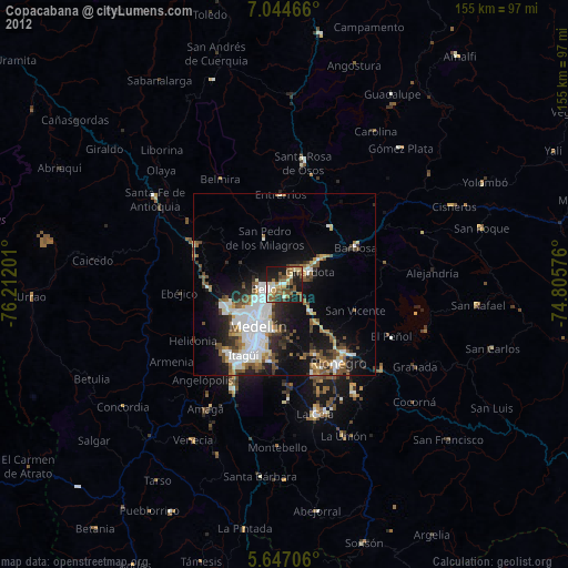
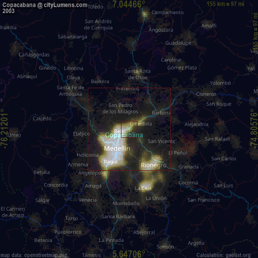
» NASA city lights 2003
» Earth at Night: Flat Maps 2012, 2016