Medellín night lights from space
Night Light of Medellín (Antioquia) from space (Colombia) Src. Average luminocity for 10x10km area is 88.881% and for 50x50km: 28.1991%.
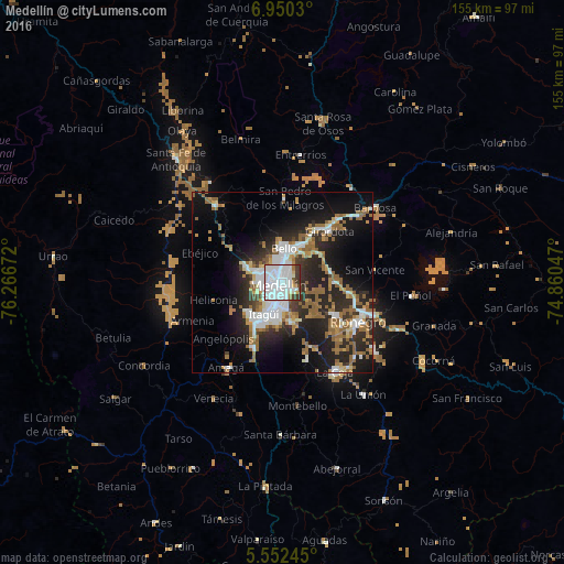
Analysis of Medellín night lights 2016
Square area 10x10 km:
 54.11%
90-99
24.68%80-89
2.81%70-79
0.87%60-69
3.03%50-59
1.95%40-49
3.25%30-39
9.31%20-29
0%10-19
0%0-9
0%Square area 50x50 km:
6.2%90-99
4.8%80-89
1.85%70-79
2.68%60-69
4.77%50-59
5.92%40-49
1.06%30-39
3.17%20-29
10.14%10-19
15.89%0-9
43.51%Clear (daylight) street map image can be seen on geolist.org.
Map coordinates:
6° 57' 1.1" North, 76° 16' 0.2" West
6° 15' 6.6" North, 75° 33' 48.9" West
5° 33' 8.8" North, 74° 51' 37.7" West
Some cities around Medellín sort by population:
• Bello
9.5 km =5.9 mi,  3°
3°
• Itagüí
8.4 km =5.2 mi,  207°
207°
• Envigado
9 km =5.6 mi,  200°
200°
• Caldas
19.6 km =12.2 mi, 204°
• La Estrella
13.7 km =8.5 mi,  220°
220°
• Copacabana
12.1 km =7.5 mi,  29°
29°
• Sabaneta
12.6 km =7.8 mi, 207°
• Guarne
13.6 km =8.5 mi,  76°
76°
3674962 (p: 1,999,979)
Sources (retrieved 2019-11-25):
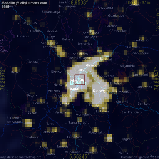
» NASA, Earths city lights 1995
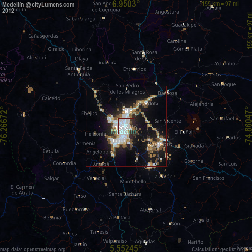
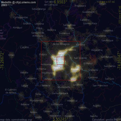
» NASA city lights 2003
» Earth at Night: Flat Maps 2012, 2016