Caloto night lights from space
Night Light of Caloto (Cauca) from space (Colombia) Src. Average luminocity for 10x10km area is 9.7121% and for 50x50km: 12.0577%.
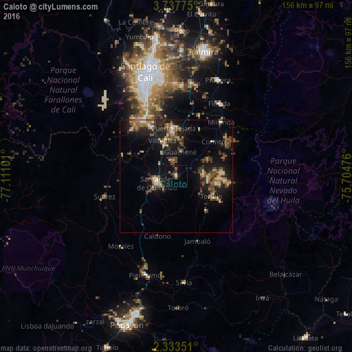
Analysis of Caloto night lights 2016
Square area 10x10 km:
 0%
0%90-99
0.87%80-89
0%70-79
0.87%60-69
1.73%50-59
0.22%40-49
3.03%30-39
3.68%20-29
0.87%10-19
5.63%0-9
83.12%Square area 50x50 km:
0.29%90-99
1.52%80-89
1.07%70-79
1.45%60-69
2.15%50-59
1.97%40-49
3.2%30-39
2.78%20-29
3.09%10-19
10.07%0-9
72.4%Clear (daylight) street map image can be seen on geolist.org.
Map coordinates:
3° 44' 15.9" North, 77° 6' 39.6" West
3° 2' 9.1" North, 76° 24' 28.4" West
2° 20' 0.6" North, 75° 42' 17.1" West
Some cities around Caloto sort by population:
• Puerto Tejada
21.7 km =13.5 mi,  357°
357°
• Florida
37.2 km =23.1 mi,  31°
31°
• Jamundí
28.7 km =17.8 mi,  330°
330°
• Santander de Quilichao
9 km =5.6 mi,  251°
251°
• Morales
39.7 km =24.7 mi,  217°
217°
• Corinto
22.2 km =13.8 mi,  46°
46°
• Miranda
31.2 km =19.4 mi,  39°
39°
• Suárez
33.3 km =20.7 mi, 254°
3687880 (p: 6,478)
Sources (retrieved 2019-11-25):
» Earth at Night: Flat Maps 2012, 2016