Ansermanuevo night lights from space
Night Light of Ansermanuevo (Valle del Cauca) from space (Colombia) Src. Average luminocity for 10x10km area is 5.0517% and for 50x50km: 4.4301%.
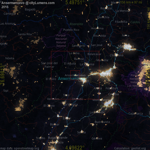
Analysis of Ansermanuevo night lights 2016
Square area 10x10 km:
 0%
0%90-99
0.41%80-89
0%70-79
0.41%60-69
0.83%50-59
1.65%40-49
0.41%30-39
2.07%20-29
1.03%10-19
3.31%0-9
89.88%Square area 50x50 km:
0.45%90-99
0.56%80-89
0.33%70-79
0.51%60-69
0.77%50-59
0.51%40-49
0.57%30-39
0.89%20-29
0.93%10-19
4.48%0-9
90.01%Clear (daylight) street map image can be seen on geolist.org.
Map coordinates:
5° 29' 51" North, 76° 41' 53.3" West
4° 47' 50" North, 75° 59' 42" West
4° 5' 46.4" North, 75° 17' 30.8" West
Some cities around Ansermanuevo sort by population:
• Cartago
10.8 km =6.7 mi,  121°
121°
• La Virginia
16.9 km =10.5 mi,  47°
47°
• Toro
22.7 km =14.1 mi,  204°
204°
• La Victoria
30.7 km =19.1 mi,  189°
189°
• Alcalá
27.2 km =16.9 mi, 120°
• Obando
24.7 km =15.3 mi,  174°
174°
• Santuario
31 km =19.3 mi,  6°
6°
• Belalcázar
29.9 km =18.6 mi,  42°
42°
3689831 (p: 12,332)
Sources (retrieved 2019-11-25):
» Earth at Night: Flat Maps 2012, 2016