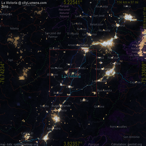
La Victoria night lights from space
Night Light of La Victoria (Valle del Cauca) from space (Colombia) Src. Average luminocity for 10x10km area is 4.5145% and for 50x50km: 3.2076%.
Analysis of La Victoria night lights 2016
Square area 10x10 km:
 0%
0%90-99
0%80-89
0%70-79
1.65%60-69
0%50-59
0.83%40-49
1.24%30-39
2.07%20-29
0.41%10-19
0.62%0-9
93.18%Square area 50x50 km:
0.33%90-99
0.4%80-89
0.23%70-79
0.39%60-69
0.5%50-59
0.49%40-49
0.61%30-39
0.77%20-29
0.42%10-19
1.24%0-9
94.62%Clear (daylight) street map image can be seen on geolist.org.
Map coordinates:
5° 13' 31.5" North, 76° 44' 32.4" West
4° 31' 29.4" North, 76° 2' 21.2" West
3° 49' 24.9" North, 75° 20' 9.9" West
Some cities around La Victoria sort by population:
• Cartago
28.4 km =17.6 mi,  29°
29°
• Zarzal
14.9 km =9.3 mi,  193°
193°
• Roldanillo
17.9 km =11.1 mi,  225°
225°
• La Tebaida
29 km =18 mi,  106°
106°
• La Unión
7.1 km =4.4 mi,  277°
277°
• Toro
10.7 km =6.6 mi,  334°
334°
• El Dovio
21.9 km =13.6 mi,  265°
265°
• Obando
9.2 km =5.7 mi,  51°
51°
3676791 (p: 11,064)
Sources (retrieved 2019-11-25):
» Earth at Night: Flat Maps 2012, 2016