Harbin night lights from space
Night Light of Harbin (Heilongjiang) from space (China) Src. Average luminocity for 10x10km area is 96.1939% and for 50x50km: 25.4841%.
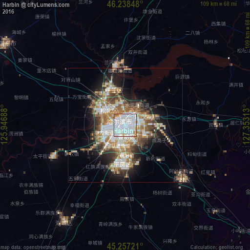
Analysis of Harbin night lights 2016
Square area 10x10 km:
 60.91%
90-99
26.52%80-89
2.88%70-79
4.39%60-69
5.15%50-59
0.15%40-49
0%30-39
0%20-29
0%10-19
0%0-9
0%Square area 50x50 km:
5.4%90-99
5.77%80-89
2.26%70-79
2.74%60-69
4.44%50-59
3.25%40-49
3.7%30-39
3.29%20-29
4.85%10-19
8.74%0-9
55.54%Clear (daylight) street map image can be seen on geolist.org.
Map coordinates:
46° 14' 18.5" North, 125° 56' 48.8" East
45° 45' 0" North, 126° 39' 0" East
45° 15' 26" North, 127° 21' 11.3" East
Some cities around Harbin sort by population:
• Zhaodong
62.6 km =38.9 mi,  304°
304°
• Acheng
34.1 km =21.2 mi,  131°
131°
• Shuangcheng
52.9 km =32.9 mi,  212°
212°
• Hulan
26.2 km =16.3 mi,  351°
351°
• Wuchang
100.8 km =62.6 mi,  157°
157°
• Lanxi
63.2 km =39.3 mi,  333°
333°
• Binzhou
64.4 km =40 mi,  89°
89°
• Bayan
68.3 km =42.4 mi,  57°
57°
2037013 (p: 5,878,939)
Sources (retrieved 2019-11-25):
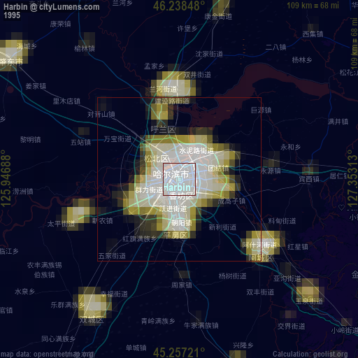
» NASA, Earths city lights 1995
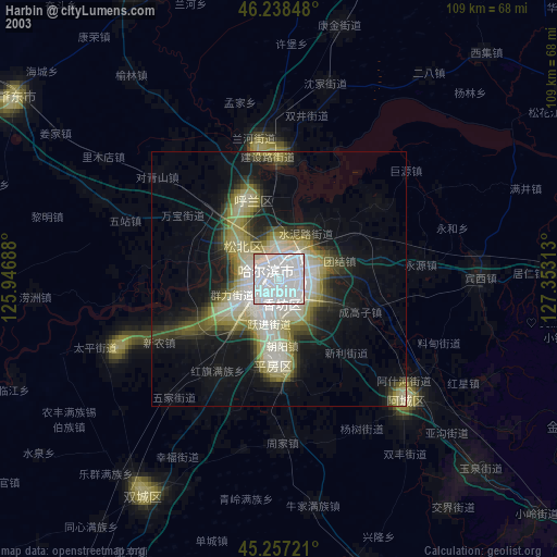
» NASA city lights 2003
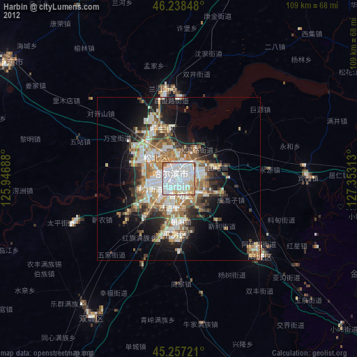
» Earth at Night: Flat Maps 2012, 2016