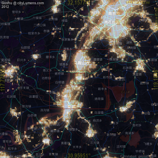
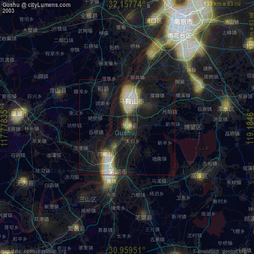
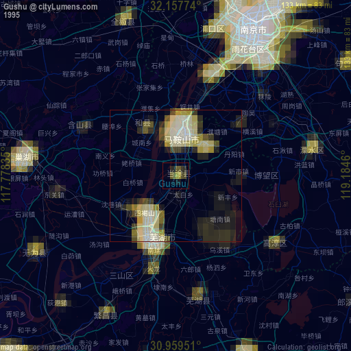
Gushu night lights from space
Night Light of Gushu (Anhui) from space (China) Src. Average luminocity for 10x10km area is 60.3916% and for 50x50km: 27.3144%.

Analysis of Gushu night lights 2016
Square area 10x10 km:
 9.97%
9.97%90-99
14.34%80-89
8.57%70-79
8.74%60-69
7.17%50-59
8.92%40-49
13.46%30-39
8.39%20-29
15.56%10-19
4.9%0-9
0%Square area 50x50 km:
5.23%90-99
5.32%80-89
3.32%70-79
3.28%60-69
3.35%50-59
3.84%40-49
4.06%30-39
4.37%20-29
6.28%10-19
12.44%0-9
48.51%Clear (daylight) street map image can be seen on geolist.org.
Map coordinates:
32° 9' 27.9" North, 117° 46' 42.1" East
31° 33' 38" North, 118° 28' 53.3" East
30° 57' 34.2" North, 119° 11' 4.6" East
Some cities around Gushu sort by population:
• Nanjing
62.4 km =38.8 mi,  26°
26°
• Wuhu
26.9 km =16.7 mi,  202°
202°
• Wusong
94.9 km =59 mi,  224°
224°
• Chuzhou
86.4 km =53.7 mi,  348°
348°
• Chaohu
58.4 km =36.3 mi,  274°
274°
• Xuanzhou
72.4 km =45 mi,  158°
158°
• Xiaolingwei
63.2 km =39.3 mi, 33°
• Hutang
95.6 km =59.4 mi,  91°
91°
1813851 (p: 60,335)
Sources (retrieved 2019-11-25):
» NASA, Earths city lights 1995
» NASA city lights 2003
» Earth at Night: Flat Maps 2012, 2016