Yicheng night lights from space
Night Light of Yicheng (Jiangsu) from space (China) Src. Average luminocity for 10x10km area is 75.6119% and for 50x50km: 23.3172%.
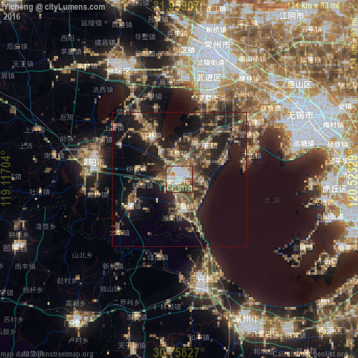

Analysis of Yicheng night lights 2016
Square area 10x10 km:
 18.88%
90-99
21.33%80-89
7.69%70-79
6.82%60-69
14.34%50-59
17.48%40-49
8.39%30-39
4.37%20-29
0.7%10-19
0%0-9
0%Square area 50x50 km:
1.26%90-99
1.99%80-89
2.95%70-79
2.61%60-69
4.23%50-59
5.34%40-49
6%30-39
4.75%20-29
9.47%10-19
16.38%0-9
45.02%Clear (daylight) street map image can be seen on geolist.org.
Map coordinates:
31° 57' 32.7" North, 119° 7' 1.3" East
31° 21' 38.1" North, 119° 49' 12.6" East
30° 45' 29.8" North, 120° 31' 23.8" East
Some cities around Yicheng sort by population:
• Suzhou
73.9 km =45.9 mi,  94°
94°
• Wuxi
50.1 km =31.1 mi,  62°
62°
• Changzhou
47.6 km =29.6 mi,  15°
15°
• Huzhou
60.4 km =37.5 mi,  154°
154°
• Licheng
32.8 km =20.4 mi,  283°
283°
• Zhicheng
40.1 km =24.9 mi,  167°
167°
• Mudu
67.4 km =41.9 mi,  99°
99°
• Hutang
36.8 km =22.9 mi,  301°
301°
1786760 (p: 95,530)
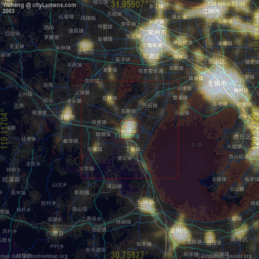
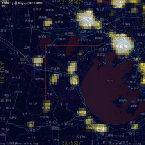
Sources (retrieved 2019-11-25):
» NASA, Earths city lights 1995
» NASA city lights 2003
» Earth at Night: Flat Maps 2012, 2016