Licheng night lights from space
Night Light of Licheng (Jiangsu) from space (China) Src. Average luminocity for 10x10km area is 61.1206% and for 50x50km: 13.2301%.
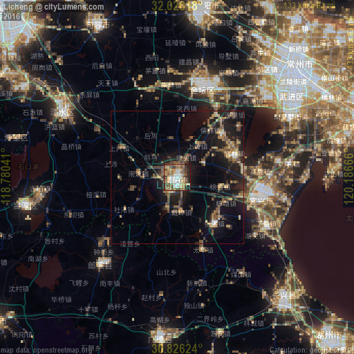
Analysis of Licheng night lights 2016
Square area 10x10 km:
 11.01%
90-99
9.62%80-89
8.22%70-79
9.97%60-69
12.59%50-59
13.64%40-49
12.59%30-39
6.12%20-29
8.04%10-19
8.22%0-9
0%Square area 50x50 km:
0.69%90-99
0.77%80-89
1.58%70-79
1.58%60-69
2.13%50-59
3.02%40-49
3%30-39
2.29%20-29
4.52%10-19
12.88%0-9
67.54%Clear (daylight) street map image can be seen on geolist.org.
Map coordinates:
32° 1' 34.2" North, 118° 46' 49.5" East
31° 25' 41.3" North, 119° 29' 0.7" East
30° 49' 34.5" North, 120° 11' 12" East
Some cities around Licheng sort by population:
• Wuxi
77.9 km =48.4 mi,  78°
78°
• Changzhou
58.8 km =36.5 mi,  49°
49°
• Zhenjiang
87.1 km =54.1 mi,  358°
358°
• Huzhou
84.9 km =52.8 mi,  136°
136°
• Xuanzhou
87.1 km =54.1 mi,  232°
232°
• Yicheng
32.8 km =20.4 mi,  103°
103°
• Zhicheng
61.8 km =38.4 mi, 139°
• Hutang
11.8 km =7.3 mi,  2°
2°
1802788 (p: 72,276)
Sources (retrieved 2019-11-25):
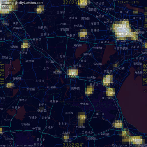
» NASA, Earths city lights 1995
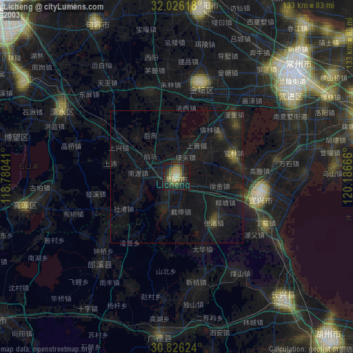
» NASA city lights 2003
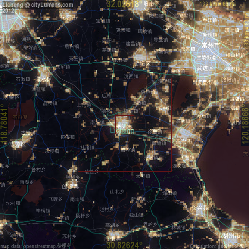
» Earth at Night: Flat Maps 2012, 2016