Wanxian night lights from space
Night Light of Wanxian (Chongqing) from space (China) Src. Average luminocity for 10x10km area is 40.7203% and for 50x50km: 3.4223%.
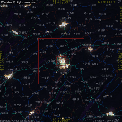

Analysis of Wanxian night lights 2016
Square area 10x10 km:
 2.97%
2.97%90-99
7.69%80-89
5.42%70-79
6.12%60-69
9.09%50-59
7.87%40-49
5.42%30-39
5.24%20-29
11.19%10-19
24.48%0-9
14.51%Square area 50x50 km:
0.21%90-99
0.51%80-89
0.36%70-79
0.42%60-69
0.74%50-59
0.6%40-49
0.57%30-39
0.32%20-29
0.9%10-19
2.97%0-9
92.4%Clear (daylight) street map image can be seen on geolist.org.
Map coordinates:
31° 25' 2.6" North, 107° 40' 4" East
30° 48' 55.6" North, 108° 22' 15.2" East
30° 12' 34.9" North, 109° 4' 26.5" East
Some cities around Wanxian sort by population:
• Nanchong
218.3 km =135.6 mi,  269°
269°
• Gaoping
216.7 km =134.7 mi, 268°
• Fuling
154.9 km =96.3 mi,  217°
217°
• Ankang
216.1 km =134.3 mi,  16°
16°
• Dazhou
94.1 km =58.5 mi,  298°
298°
• Beibei
215.7 km =134 mi,  239°
239°
• Enshi
121 km =75.2 mi,  118°
118°
• Lichuan
73.4 km =45.6 mi,  141°
141°
1791748 (p: 188,980)
Sources (retrieved 2019-11-25):
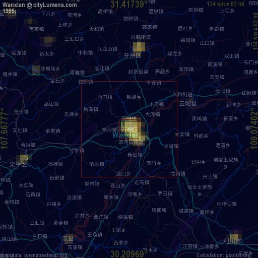
» NASA, Earths city lights 1995
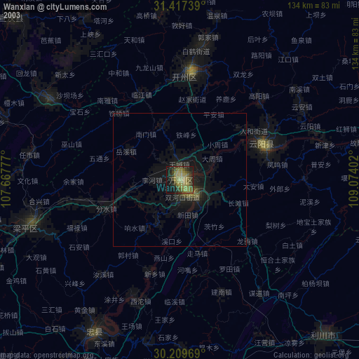
» NASA city lights 2003
» Earth at Night: Flat Maps 2012, 2016