Beibei night lights from space
Night Light of Beibei (Chongqing) from space (China) Src. Average luminocity for 10x10km area is 31.5655% and for 50x50km: 24.9149%.
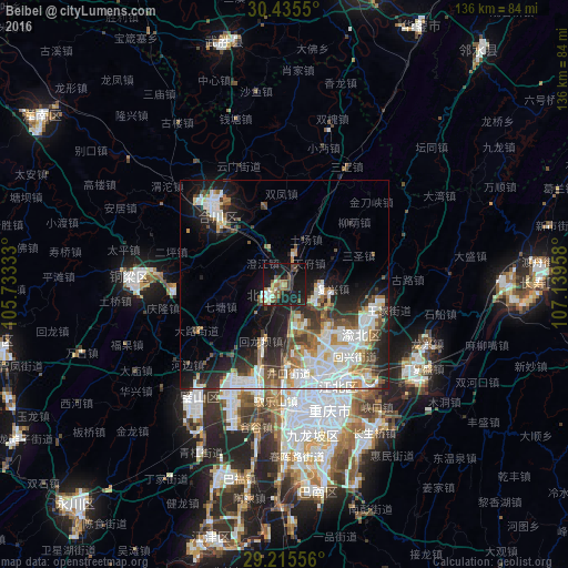
Analysis of Beibei night lights 2016
Square area 10x10 km:
 2.18%
2.18%90-99
5.16%80-89
2.58%70-79
2.98%60-69
5.36%50-59
8.13%40-49
5.36%30-39
3.97%20-29
2.38%10-19
48.81%0-9
13.1%Square area 50x50 km:
6.27%90-99
5.96%80-89
1.85%70-79
2.21%60-69
2.74%50-59
3.02%40-49
3.26%30-39
3.09%20-29
5.71%10-19
11.15%0-9
54.74%Clear (daylight) street map image can be seen on geolist.org.
Map coordinates:
30° 26' 7.8" North, 105° 43' 60" East
29° 49' 38.6" North, 106° 26' 11.2" East
29° 12' 56" North, 107° 8' 22.5" East
Some cities around Beibei sort by population:
• Chongqing
31.5 km =19.6 mi,  159°
159°
• Gaoping
110.2 km =68.5 mi,  343°
343°
• Fuling
93.6 km =58.2 mi,  98°
98°
• Suining
112.3 km =69.8 mi,  312°
312°
• Hechuan
24.7 km =15.3 mi,  317°
317°
• Yongchuan
74.3 km =46.2 mi,  224°
224°
• Yudong
49.8 km =30.9 mi,  170°
170°
• Jijiang
62.4 km =38.8 mi,  196°
196°
1816790 (p: 112,019)
Sources (retrieved 2019-11-25):
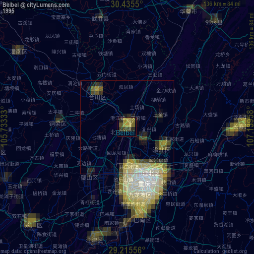
» NASA, Earths city lights 1995
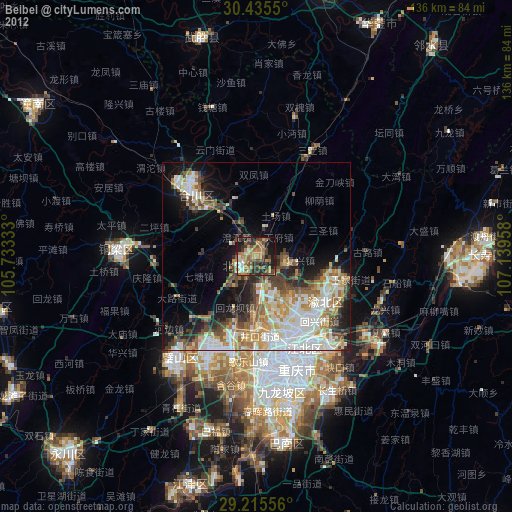
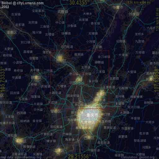
» NASA city lights 2003
» Earth at Night: Flat Maps 2012, 2016