Shanting night lights from space
Night Light of Shanting (Shandong) from space (China) Src. Average luminocity for 10x10km area is 9.9738% and for 50x50km: 4.7644%.
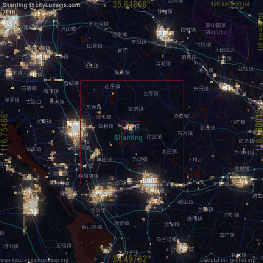
Analysis of Shanting night lights 2016
Square area 10x10 km:
 0.7%
0.7%90-99
0%80-89
1.4%70-79
1.92%60-69
4.37%50-59
1.4%40-49
0.87%30-39
1.4%20-29
1.4%10-19
1.92%0-9
84.62%Square area 50x50 km:
0.34%90-99
0.44%80-89
0.53%70-79
0.52%60-69
0.75%50-59
0.8%40-49
0.9%30-39
0.76%20-29
1.27%10-19
3.96%0-9
89.73%Clear (daylight) street map image can be seen on geolist.org.
Map coordinates:
35° 38' 55.2" North, 116° 45' 16.8" East
35° 4' 31" North, 117° 27' 28" East
34° 29' 52.2" North, 118° 9' 39.3" East
Some cities around Shanting sort by population:
• Zoucheng
57.5 km =35.7 mi,  308°
308°
• Zaozhuang
25 km =15.5 mi,  159°
159°
• Xiazhen
43.8 km =27.2 mi,  226°
226°
• Chengtangcun
24.3 km =15.1 mi,  272°
272°
• Feicheng
50.7 km =31.5 mi,  66°
66°
• Pingyi
49.8 km =30.9 mi,  18°
18°
• Bianzhuang
59.1 km =36.7 mi,  115°
115°
• Taozhuang
27.5 km =17.1 mi,  204°
204°
1795941 (p: 80,843)
Sources (retrieved 2019-11-25):
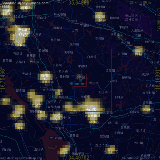
» NASA, Earths city lights 1995
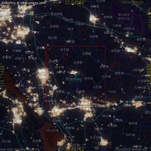
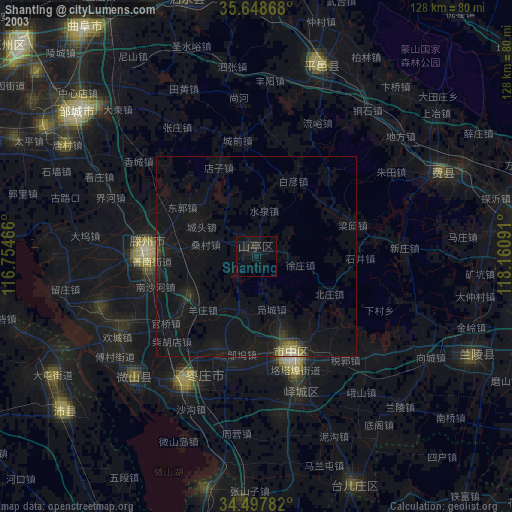
» NASA city lights 2003
» Earth at Night: Flat Maps 2012, 2016