Bianzhuang night lights from space
Night Light of Bianzhuang (Shandong) from space (China) Src. Average luminocity for 10x10km area is 35.5311% and for 50x50km: 9.786%.
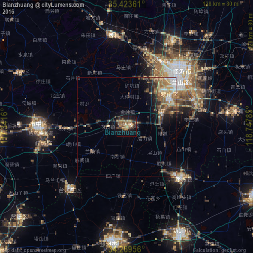
Analysis of Bianzhuang night lights 2016
Square area 10x10 km:
 0.37%
0.37%90-99
1.28%80-89
6.04%70-79
7.69%60-69
11.54%50-59
9.16%40-49
3.66%30-39
6.41%20-29
6.96%10-19
29.12%0-9
17.77%Square area 50x50 km:
0.86%90-99
0.98%80-89
1.23%70-79
1.5%60-69
2.05%50-59
2.16%40-49
1.65%30-39
2.24%20-29
2.05%10-19
4.81%0-9
80.46%Clear (daylight) street map image can be seen on geolist.org.
Map coordinates:
35° 25' 25" North, 117° 20' 29.8" East
34° 50' 55" North, 118° 2' 41" East
34° 16' 10.4" North, 118° 44' 52.3" East
Some cities around Bianzhuang sort by population:
• Linyi
36.1 km =22.4 mi,  48°
48°
• Zaozhuang
44.8 km =27.8 mi,  272°
272°
• Shizilu
79.9 km =49.6 mi,  63°
63°
• Pizhou
60.4 km =37.5 mi,  188°
188°
• Feicheng
46.3 km =28.8 mi,  351°
351°
• Shanting
59.1 km =36.7 mi,  295°
295°
• Xiazhuang
54.7 km =34 mi,  82°
82°
• Taozhuang
64.9 km =40.3 mi, 270°
1816406 (p: 65,381)
Sources (retrieved 2019-11-25):
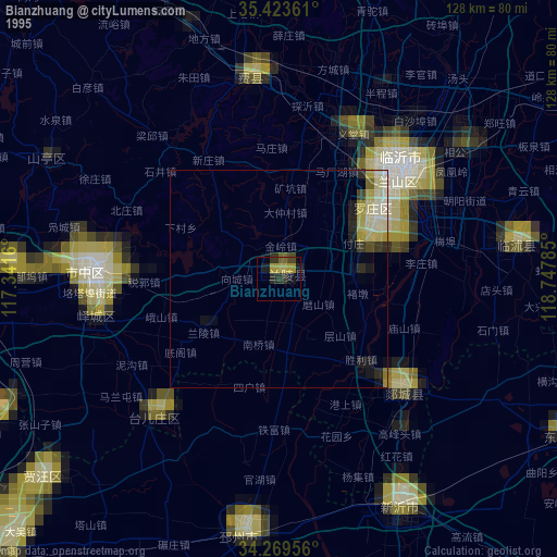
» NASA, Earths city lights 1995
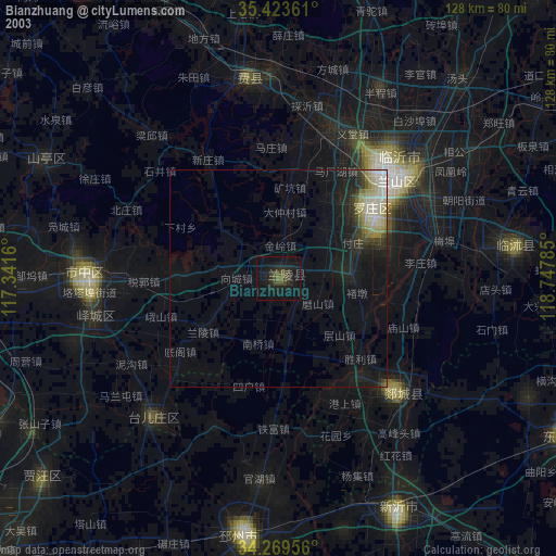
» NASA city lights 2003
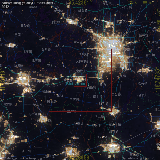
» Earth at Night: Flat Maps 2012, 2016