Qianjiang night lights from space
Night Light of Qianjiang (Hubei) from space (China) Src. Average luminocity for 10x10km area is 35.8956% and for 50x50km: 3.5171%.
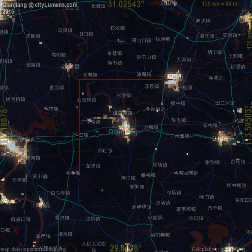

Analysis of Qianjiang night lights 2016
Square area 10x10 km:
 2.2%
2.2%90-99
4.58%80-89
5.86%70-79
7.14%60-69
5.13%50-59
6.78%40-49
3.85%30-39
4.76%20-29
11.36%10-19
36.45%0-9
11.9%Square area 50x50 km:
0.24%90-99
0.39%80-89
0.37%70-79
0.48%60-69
0.59%50-59
0.5%40-49
0.5%30-39
0.63%20-29
1.09%10-19
3.2%0-9
92.02%Clear (daylight) street map image can be seen on geolist.org.
Map coordinates:
31° 1' 31.5" North, 112° 11' 19.6" East
30° 25' 15.6" North, 112° 53' 30.8" East
29° 48' 46.1" North, 113° 35' 42.1" East
Some cities around Qianjiang sort by population:
• Shashi
63.4 km =39.4 mi,  258°
258°
• Xiantao
53.1 km =33 mi,  96°
96°
• Jingling
32.3 km =20.1 mi,  38°
38°
• Jingzhou
67.8 km =42.1 mi, 263°
• Buhe
65.2 km =40.5 mi, 256°
• Xinshi
73.6 km =45.7 mi,  18°
18°
• Duobao
33.8 km =21 mi,  325°
325°
• Fengkou
56.7 km =35.2 mi,  131°
131°
1786067 (p: 179,079)
Sources (retrieved 2019-11-25):
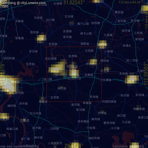
» NASA, Earths city lights 1995
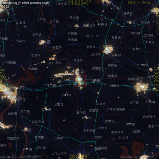
» NASA city lights 2003
» Earth at Night: Flat Maps 2012, 2016