Buhe night lights from space
Night Light of Buhe (Hubei) from space (China) Src. Average luminocity for 10x10km area is 34.337% and for 50x50km: 6.3818%.
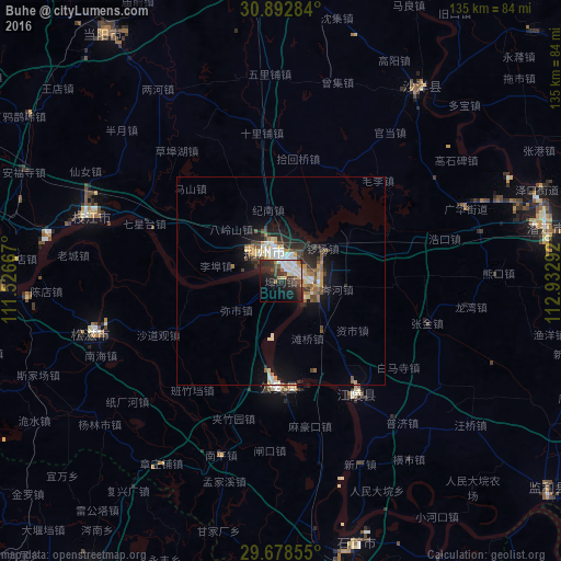
Analysis of Buhe night lights 2016
Square area 10x10 km:
 7.88%
7.88%90-99
5.68%80-89
4.03%70-79
1.83%60-69
3.11%50-59
3.3%40-49
4.58%30-39
4.21%20-29
19.96%10-19
22.34%0-9
23.08%Square area 50x50 km:
0.88%90-99
0.99%80-89
0.82%70-79
0.75%60-69
0.7%50-59
0.79%40-49
1.01%30-39
0.88%20-29
2.13%10-19
4.49%0-9
86.57%Clear (daylight) street map image can be seen on geolist.org.
Map coordinates:
30° 53' 34.2" North, 111° 31' 36" East
30° 17' 15.3" North, 112° 13' 47.2" East
29° 40' 42.8" North, 112° 55' 58.5" East
Some cities around Buhe sort by population:
• Shashi
2.6 km =1.6 mi,  33°
33°
• Qianjiang
65.2 km =40.5 mi,  76°
76°
• Jingzhou
7.9 km =4.9 mi,  331°
331°
• Jingmen
83 km =51.6 mi,  358°
358°
• Zhicheng
69.6 km =43.2 mi,  270°
270°
• Xiulin
65.6 km =40.8 mi,  165°
165°
• Duobao
61.2 km =38 mi,  46°
46°
• Zhijiang
48.1 km =29.9 mi,  288°
288°
1816221 (p: 106,347)
Sources (retrieved 2019-11-25):
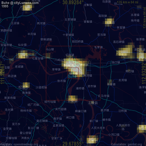
» NASA, Earths city lights 1995
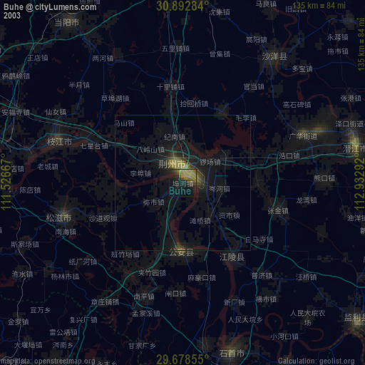
» NASA city lights 2003
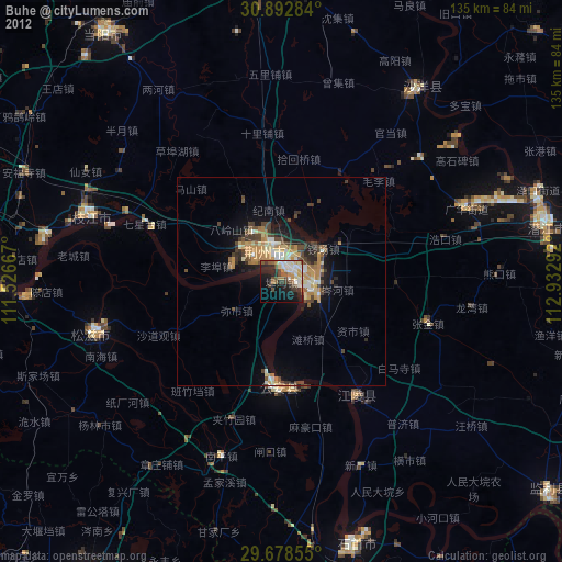
» Earth at Night: Flat Maps 2012, 2016