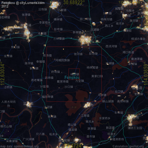
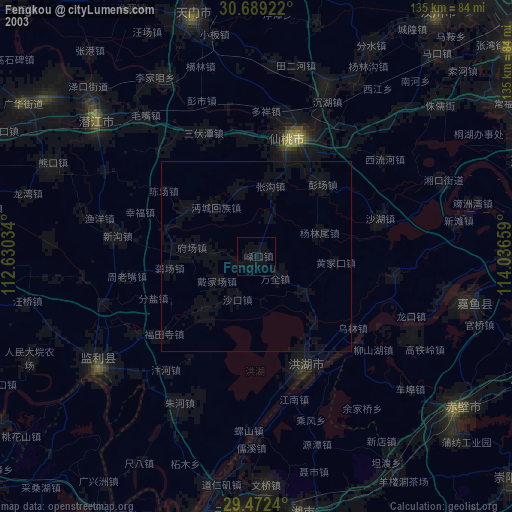
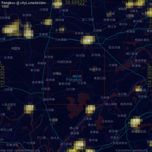
Fengkou night lights from space
Night Light of Fengkou (Hubei) from space (China) Src. Average luminocity for 10x10km area is 0.4053% and for 50x50km: 0.137%.
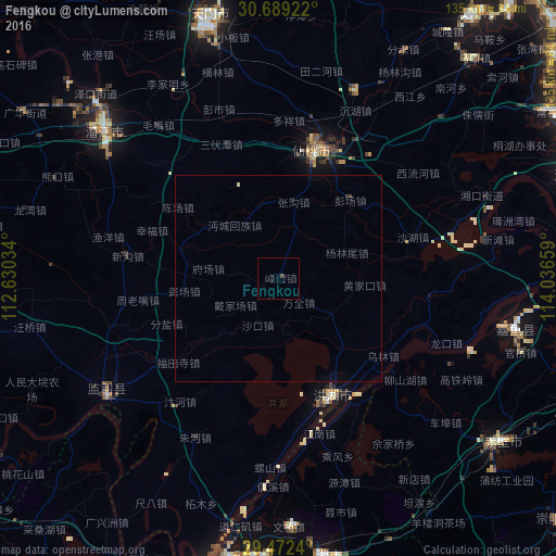
Analysis of Fengkou night lights 2016
Square area 10x10 km:
 0%
0%90-99
0%80-89
0%70-79
0%60-69
0%50-59
0%40-49
0.76%30-39
0%20-29
0%10-19
0.76%0-9
98.48%Square area 50x50 km:
0%90-99
0.03%80-89
0%70-79
0%60-69
0%50-59
0%40-49
0.04%30-39
0.05%20-29
0%10-19
0.06%0-9
99.82%Clear (daylight) street map image can be seen on geolist.org.
Map coordinates:
30° 41' 21.2" North, 112° 37' 49.2" East
30° 4' 57.6" North, 113° 20' 0.5" East
29° 28' 20.6" North, 114° 2' 11.7" East
Some cities around Fengkou sort by population:
• Yueyang
82 km =51 mi,  196°
196°
• Xiantao
33.7 km =20.9 mi,  18°
18°
• Jingling
66.9 km =41.6 mi,  340°
340°
• Qianjiang
56.7 km =35.2 mi,  311°
311°
• Xindi
32.2 km =20 mi,  156°
156°
• Puqi
66.8 km =41.5 mi,  127°
127°
• Hanchuan
75.5 km =46.9 mi,  33°
33°
• Caidian
87.2 km =54.2 mi,  50°
50°
1811305 (p: 67,139)
Sources (retrieved 2019-11-25):
» NASA, Earths city lights 1995
» NASA city lights 2003
» Earth at Night: Flat Maps 2012, 2016