Shangrao night lights from space
Night Light of Shangrao (Jiangxi) from space (China) Src. Average luminocity for 10x10km area is 69.2956% and for 50x50km: 6.2251%.
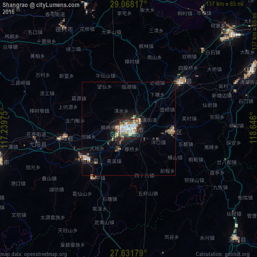
Analysis of Shangrao night lights 2016
Square area 10x10 km:
 18.85%
90-99
21.23%80-89
6.55%70-79
7.34%60-69
5.36%50-59
8.53%40-49
10.12%30-39
9.72%20-29
9.72%10-19
2.58%0-9
0%Square area 50x50 km:
0.88%90-99
1.09%80-89
0.59%70-79
0.68%60-69
0.77%50-59
0.86%40-49
0.83%30-39
0.94%20-29
1.61%10-19
4.47%0-9
87.27%Clear (daylight) street map image can be seen on geolist.org.
Map coordinates:
29° 4' 5.4" North, 117° 14' 23.1" East
28° 27' 6.4" North, 117° 56' 34.3" East
27° 49' 54.4" North, 118° 38' 45.6" East
Some cities around Shangrao sort by population:
• Jingdezhen
117.9 km =73.3 mi,  322°
322°
• Shaowu
131.5 km =81.7 mi,  200°
200°
• Quzhou
106.5 km =66.2 mi,  57°
57°
• Guixi
73.6 km =45.7 mi,  255°
255°
• Poyang
138.1 km =85.8 mi,  295°
295°
• Wucheng
129.7 km =80.6 mi,  10°
10°
• Pucheng
82.5 km =51.3 mi,  135°
135°
• Wuyishan
77.4 km =48.1 mi,  173°
173°
1787858 (p: 318,769)
Sources (retrieved 2019-11-25):
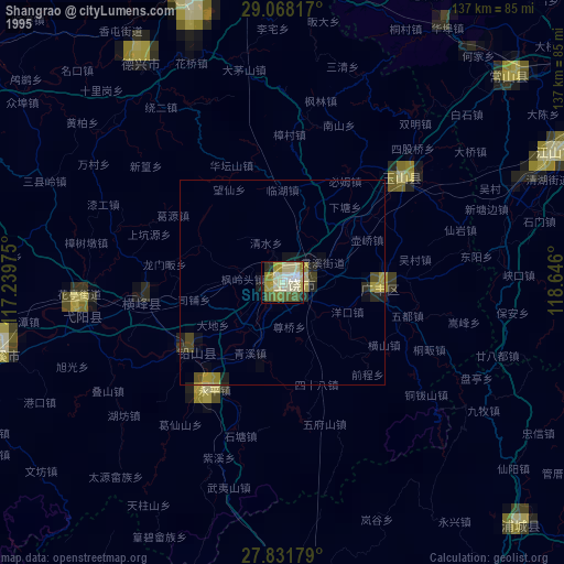
» NASA, Earths city lights 1995
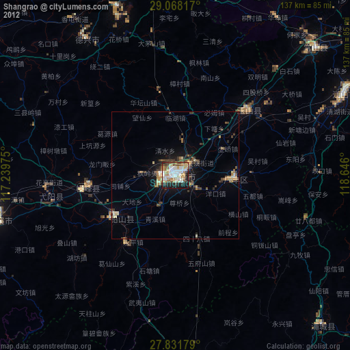
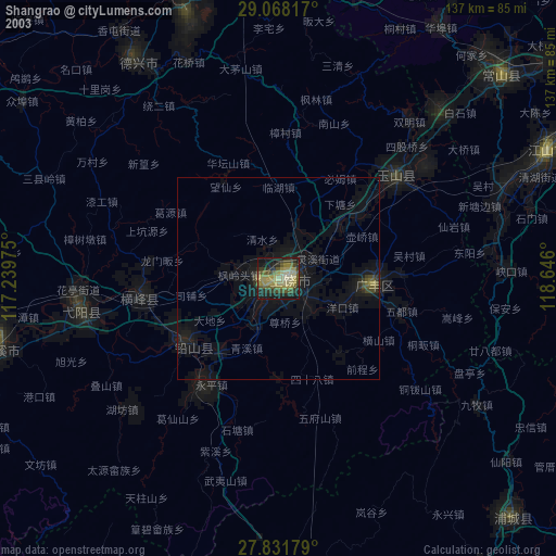
» NASA city lights 2003
» Earth at Night: Flat Maps 2012, 2016