Binzhou night lights from space
Night Light of Binzhou (Heilongjiang) from space (China) Src. Average luminocity for 10x10km area is 5.1106% and for 50x50km: 0.419%.
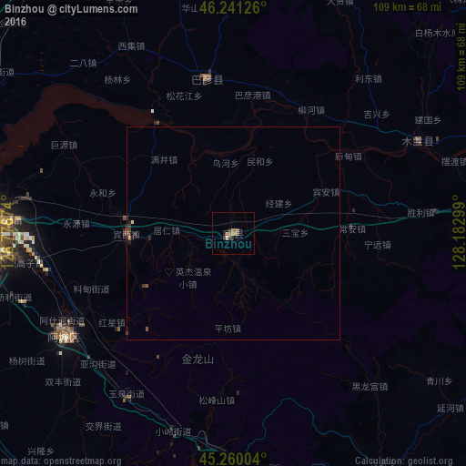
Analysis of Binzhou night lights 2016
Square area 10x10 km:
 0%
0%90-99
0.61%80-89
0%70-79
0.61%60-69
2%50-59
1.54%40-49
1.38%30-39
0%20-29
1.84%10-19
0.61%0-9
91.4%Square area 50x50 km:
0%90-99
0.04%80-89
0.01%70-79
0.03%60-69
0.14%50-59
0.11%40-49
0.08%30-39
0.16%20-29
0.18%10-19
0.06%0-9
99.18%Clear (daylight) street map image can be seen on geolist.org.
Map coordinates:
46° 14' 28.5" North, 126° 46' 36.3" East
45° 45' 10.1" North, 127° 28' 47.5" East
45° 15' 36.1" North, 128° 10' 58.8" East
Some cities around Binzhou sort by population:
• Harbin
64.4 km =40 mi,  269°
269°
• Acheng
45.4 km =28.2 mi,  239°
239°
• Shuangcheng
103.4 km =64.2 mi, 244°
• Hulan
72.8 km =45.2 mi,  290°
290°
• Wuchang
96.7 km =60.1 mi,  195°
195°
• Shangzhi
71.2 km =44.2 mi,  147°
147°
• Shanhecun
85.5 km =53.1 mi,  93°
93°
• Bayan
36.4 km =22.6 mi,  350°
350°
2038283 (p: 62,017)
Sources (retrieved 2019-11-25):
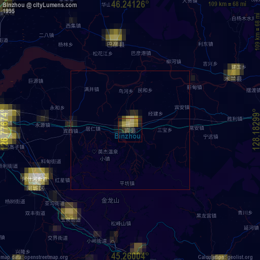
» NASA, Earths city lights 1995
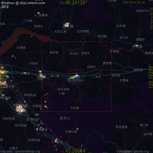
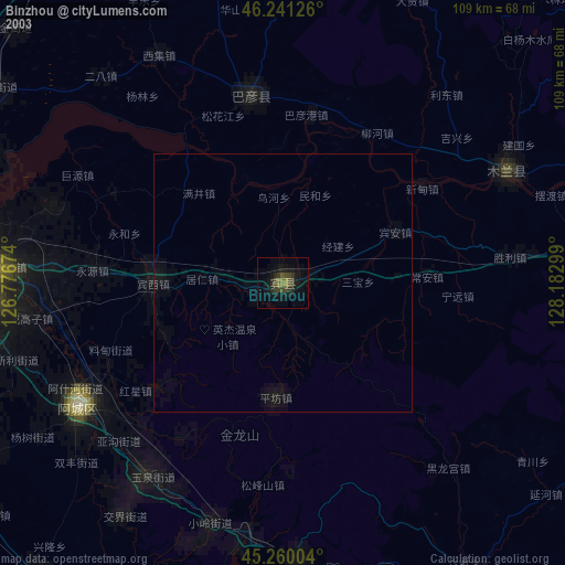
» NASA city lights 2003
» Earth at Night: Flat Maps 2012, 2016