Erdaojiang night lights from space
Night Light of Erdaojiang (Jilin) from space (China) Src. Average luminocity for 10x10km area is 9.2597% and for 50x50km: 1.6736%.
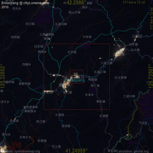
Analysis of Erdaojiang night lights 2016
Square area 10x10 km:
 0%
0%90-99
0.32%80-89
0%70-79
0.65%60-69
0.65%50-59
2.76%40-49
2.92%30-39
6.33%20-29
4.71%10-19
1.3%0-9
80.36%Square area 50x50 km:
0%90-99
0.13%80-89
0.15%70-79
0.14%60-69
0.23%50-59
0.56%40-49
0.3%30-39
0.57%20-29
0.52%10-19
0.78%0-9
96.62%Clear (daylight) street map image can be seen on geolist.org.
Map coordinates:
42° 17' 55" North, 125° 19' 43.8" East
41° 46' 35" North, 126° 1' 55" East
41° 14' 59.6" North, 126° 44' 6.3" East
Some cities around Erdaojiang sort by population:
• Tonghua
10.8 km =6.7 mi,  234°
234°
• Baishan
36.8 km =22.9 mi,  60°
60°
• Manp’o, KP
72.4 km =45 mi,  162°
162°
• Linjiang
72.7 km =45.2 mi,  87°
87°
• Liuhe
57.7 km =35.9 mi,  333°
333°
• Sanchazi
58 km =36 mi,  54°
54°
• Huanren
79.4 km =49.3 mi,  224°
224°
• Chasŏng, KP
61.6 km =38.3 mi,  124°
124°
2037494 (p: 60,831)
Sources (retrieved 2019-11-25):
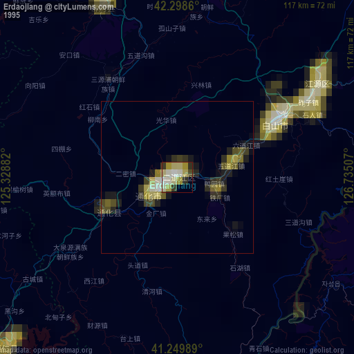
» NASA, Earths city lights 1995
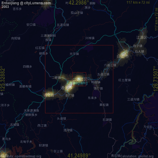
» NASA city lights 2003
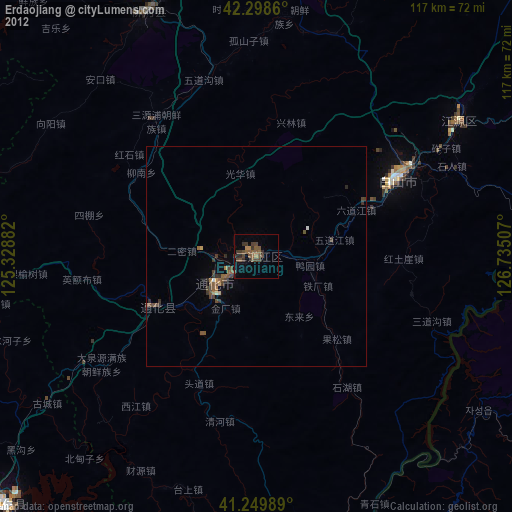
» Earth at Night: Flat Maps 2012, 2016