Chasŏng night lights from space
Night Light of Chasŏng (Chagang-do) from space (North Korea) Src. Average luminocity for 10x10km area is 0% and for 50x50km: 0.0319%.
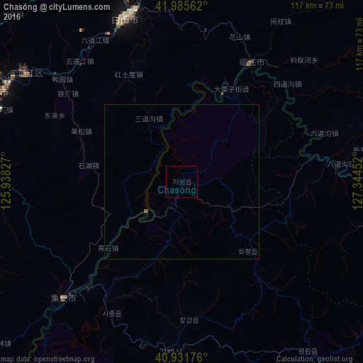
Analysis of Chasŏng night lights 2016
Square area 10x10 km:
 0%
0%90-99
0%80-89
0%70-79
0%60-69
0%50-59
0%40-49
0%30-39
0%20-29
0%10-19
0%0-9
100%Square area 50x50 km:
0%90-99
0%80-89
0%70-79
0%60-69
0%50-59
0.05%40-49
0%30-39
0%20-29
0%10-19
0%0-9
99.95%Clear (daylight) street map image can be seen on geolist.org.
Map coordinates:
41° 59' 8.2" North, 125° 56' 17.8" East
41° 27' 39" North, 126° 38' 29" East
40° 55' 54.3" North, 127° 20' 40.3" East
Some cities around Chasŏng sort by population:
• Tonghua, CN
66.1 km =41.1 mi,  295°
295°
• Kanggye
54.8 km =34.1 mi,  184°
184°
• Baishan, CN
56.2 km =34.9 mi,  340°
340°
• Manp’o
45 km =28 mi,  220°
220°
• Linjiang, CN
44.4 km =27.6 mi,  29°
29°
• Sanchazi, CN
69.1 km =42.9 mi,  357°
357°
• Hepingjie, CN
70.4 km =43.7 mi,  18°
18°
• Erdaojiang, CN
61.6 km =38.3 mi, 304°
2045005 (p: 12,736)
Sources (retrieved 2019-11-25):
» Earth at Night: Flat Maps 2012, 2016