Danshui night lights from space
Night Light of Danshui (Guangdong) from space (China) Src. Average luminocity for 10x10km area is 83.2083% and for 50x50km: 44.8706%.

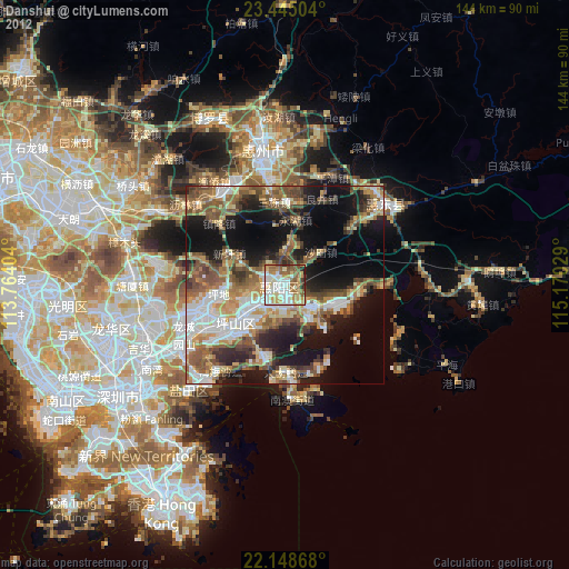
Analysis of Danshui night lights 2016
Square area 10x10 km:
 25.4%
25.4%90-99
22.62%80-89
13.69%70-79
12.7%60-69
11.51%50-59
11.31%40-49
2.78%30-39
0%20-29
0%10-19
0%0-9
0%Square area 50x50 km:
8.29%90-99
7.9%80-89
4.47%70-79
7.06%60-69
6.23%50-59
8.3%40-49
7.74%30-39
6.91%20-29
10.28%10-19
17.53%0-9
15.3%Clear (daylight) street map image can be seen on geolist.org.
Map coordinates:
23° 26' 42.1" North, 113° 45' 50.5" East
22° 47' 54.2" North, 114° 28' 1.8" East
22° 8' 55.2" North, 115° 10' 13" East
Some cities around Danshui sort by population:
• Shenzhen
49.6 km =30.8 mi,  235°
235°
• Huizhou
35.2 km =21.9 mi,  351°
351°
• Luoyang
45.1 km =28 mi,  333°
333°
• Pingshan
33.3 km =20.7 mi,  49°
49°
• Sha Tin, HK
54.6 km =33.9 mi,  212°
212°
• Tai Po, HK
49.4 km =30.7 mi,  218°
218°
• Sai Kung, HK
50.5 km =31.4 mi,  204°
204°
• Wong Tai Sin, HK
57.7 km =35.9 mi, 210°
1813812 (p: 126,701)
Sources (retrieved 2019-11-25):
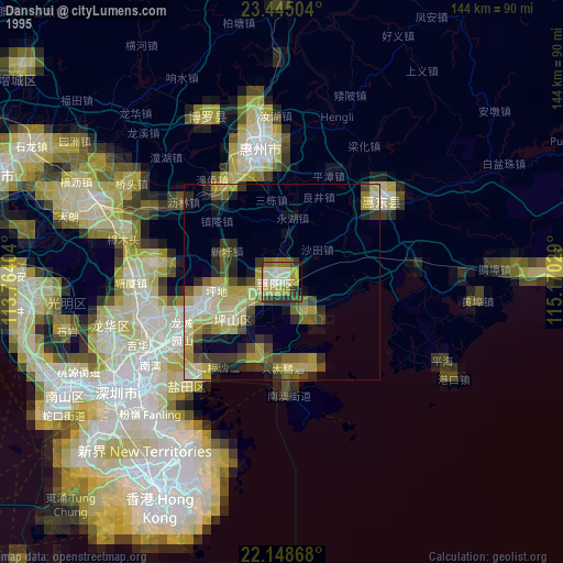
» NASA, Earths city lights 1995
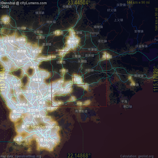
» NASA city lights 2003
» Earth at Night: Flat Maps 2012, 2016