Chifeng night lights from space
Night Light of Chifeng (Inner Mongolia) from space (China) Src. Average luminocity for 10x10km area is 68.1076% and for 50x50km: 7.182%.
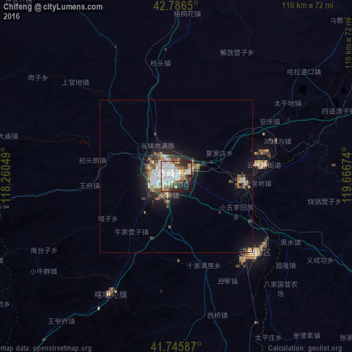
Analysis of Chifeng night lights 2016
Square area 10x10 km:
 25%
25%90-99
16.67%80-89
6.82%70-79
6.67%60-69
6.06%50-59
7.12%40-49
5.76%30-39
5.3%20-29
11.52%10-19
7.58%0-9
1.52%Square area 50x50 km:
1.6%90-99
1.22%80-89
0.75%70-79
0.5%60-69
0.96%50-59
0.89%40-49
0.83%30-39
1.2%20-29
1.78%10-19
4.04%0-9
86.23%Clear (daylight) street map image can be seen on geolist.org.
Map coordinates:
42° 47' 11.4" North, 118° 15' 37.8" East
42° 16' 6" North, 118° 57' 49" East
41° 44' 45.1" North, 119° 40' 0.3" East
Some cities around Chifeng sort by population:
• Chengde
168.5 km =104.7 mi,  209°
209°
• Chaoyang
146 km =90.7 mi,  122°
122°
• Nanpiao
197.2 km =122.5 mi,  131°
131°
• Beipiao
159 km =98.8 mi,  109°
109°
• Lingyuan
120 km =74.6 mi,  162°
162°
• Pingzhuang
37.1 km =23.1 mi, 133°
• Yebaishou
111.9 km =69.5 mi,  149°
149°
• Mujiayingzi
22.5 km =14 mi,  221°
221°
2038067 (p: 346,654)
Sources (retrieved 2019-11-25):
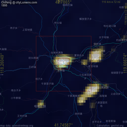
» NASA, Earths city lights 1995
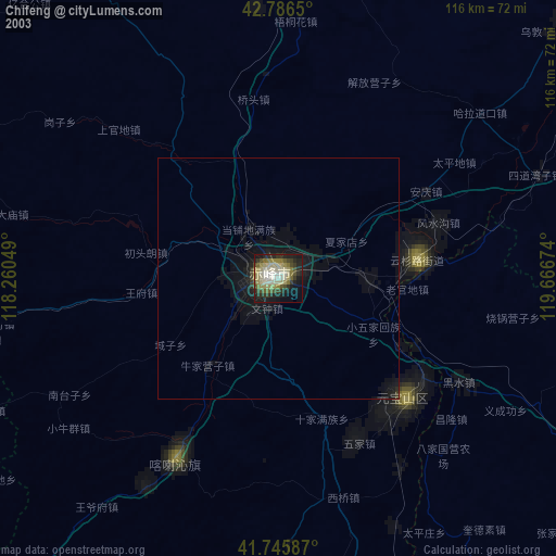
» NASA city lights 2003
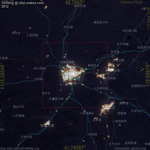
» Earth at Night: Flat Maps 2012, 2016