Chuzhou night lights from space
Night Light of Chuzhou (Anhui) from space (China) Src. Average luminocity for 10x10km area is 63.0293% and for 50x50km: 12.8391%.
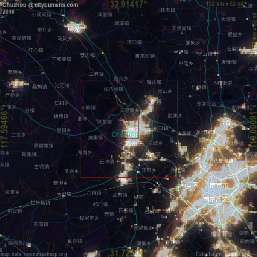
Analysis of Chuzhou night lights 2016
Square area 10x10 km:
 20.51%
90-99
18.32%80-89
6.23%70-79
3.85%60-69
6.04%50-59
5.86%40-49
6.78%30-39
4.58%20-29
10.62%10-19
15.2%0-9
2.01%Square area 50x50 km:
2.12%90-99
2.48%80-89
1.37%70-79
1.2%60-69
1.45%50-59
1.37%40-49
1.48%30-39
2.18%20-29
4.32%10-19
9.27%0-9
72.77%Clear (daylight) street map image can be seen on geolist.org.
Map coordinates:
32° 54' 51" North, 117° 35' 40.8" East
32° 19' 19" North, 118° 17' 52" East
31° 43' 33" North, 119° 0' 3.3" East
Some cities around Chuzhou sort by population:
• Nanjing
53.6 km =33.3 mi,  122°
122°
• Hefei
108.5 km =67.4 mi,  242°
242°
• Yangzhou
107.2 km =66.6 mi,  85°
85°
• Zhenzhou
82.1 km =51 mi, 93°
• Chaohu
90 km =55.9 mi,  206°
206°
• Mingguang
59.8 km =37.2 mi,  328°
328°
• Xiaolingwei
61.5 km =38.2 mi, 121°
• Gushu
86.4 km =53.7 mi,  168°
168°
1814757 (p: 280,582)
Sources (retrieved 2019-11-25):
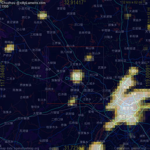
» NASA, Earths city lights 1995
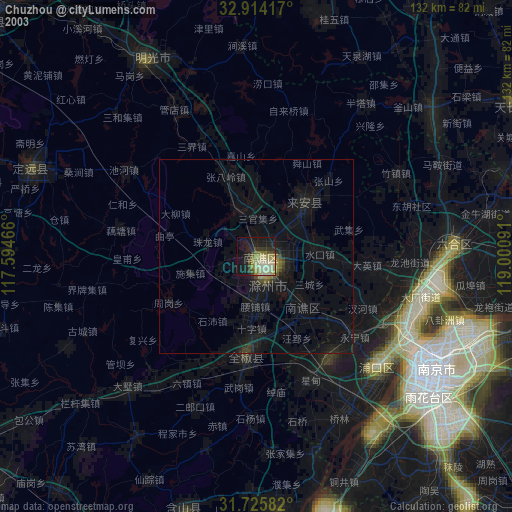
» NASA city lights 2003
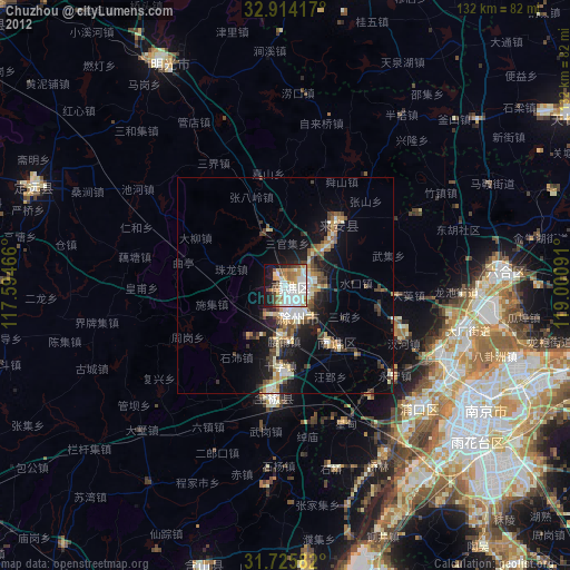
» Earth at Night: Flat Maps 2012, 2016