Ngaoundéré night lights from space
Night Light of Ngaoundéré (Adamaoua) from space (Cameroon) Src. Average luminocity for 10x10km area is 15.7576% and for 50x50km: 0.6574%.
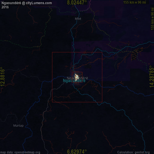

Analysis of Ngaoundéré night lights 2016
Square area 10x10 km:
 0%
0%90-99
1.73%80-89
3.03%70-79
5.63%60-69
0.87%50-59
1.73%40-49
0.87%30-39
4.76%20-29
2.38%10-19
1.52%0-9
77.49%Square area 50x50 km:
0%90-99
0.07%80-89
0.12%70-79
0.22%60-69
0.03%50-59
0.07%40-49
0.03%30-39
0.19%20-29
0.09%10-19
0.06%0-9
99.12%Clear (daylight) street map image can be seen on geolist.org.
Map coordinates:
8° 1' 28.1" North, 12° 52' 53.8" East
7° 19' 39.5" North, 13° 35' 5" East
6° 37' 47.1" North, 14° 17' 16.3" East
Some cities around Ngaoundéré sort by population:
• Meïganga
119.9 km =74.5 mi,  138°
138°
• Tibati
142.6 km =88.6 mi,  227°
227°
• Tcholliré
135.7 km =84.3 mi,  28°
28°
• Toungo, NG
190.9 km =118.6 mi,  297°
297°
• Rey Bouba
163.2 km =101.4 mi,  23°
23°
• Kontcha
165 km =102.5 mi, 295°
• Bélel
98.6 km =61.3 mi,  108°
108°
• Poli
133.1 km =82.7 mi,  343°
343°
2224827 (p: 231,357)
Sources (retrieved 2019-11-25):
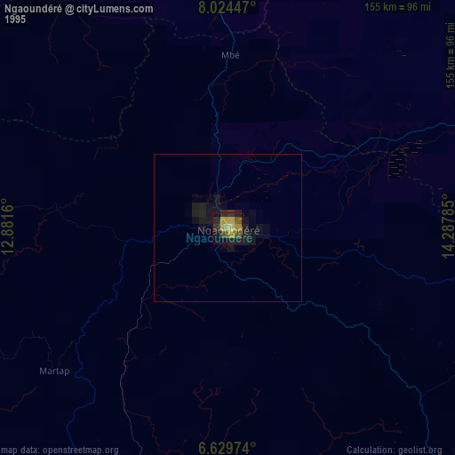
» NASA, Earths city lights 1995
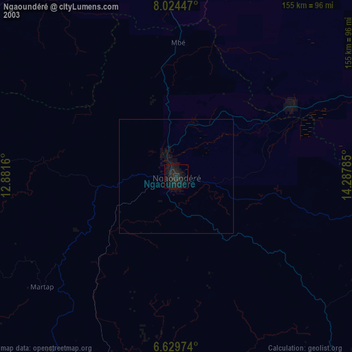
» NASA city lights 2003
» Earth at Night: Flat Maps 2012, 2016