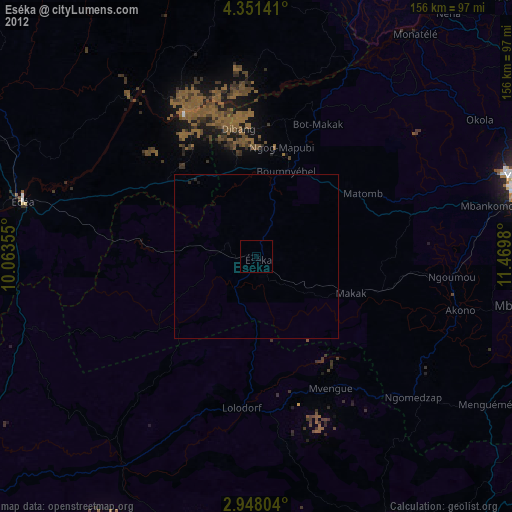
Eséka night lights from space
Night Light of Eséka (Centre) from space (Cameroon) Src. Average luminocity for 10x10km area is 0% and for 50x50km: 0%.
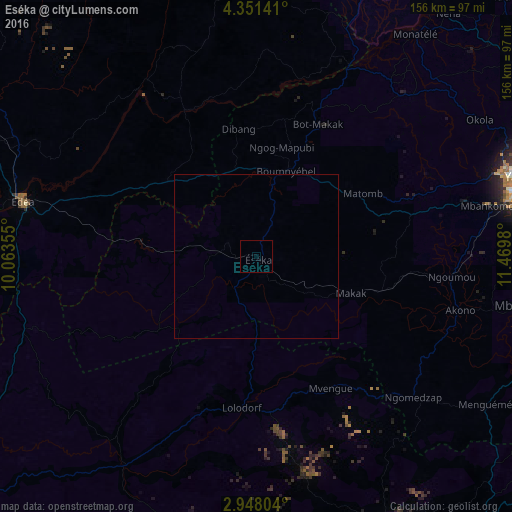
Analysis of Eséka night lights 2016
Square area 10x10 km:
100  0%
0%
90-99 0%
80-89 0%
70-79 0%
60-69 0%
50-59 0%
40-49 0%
30-39 0%
20-29 0%
10-19 0%
0-9 100%
0%90-99
0%80-89
0%70-79
0%60-69
0%50-59
0%40-49
0%30-39
0%20-29
0%10-19
0%0-9
100%Square area 50x50 km:
100 0%
90-99 0%
80-89 0%
70-79 0%
60-69 0%
50-59 0%
40-49 0%
30-39 0%
20-29 0%
10-19 0%
0-9 100%
0%90-99
0%80-89
0%70-79
0%60-69
0%50-59
0%40-49
0%30-39
0%20-29
0%10-19
0%0-9
100%Clear (daylight) street map image can be seen on geolist.org.
Map coordinates:
4° 21' 5.1" North, 10° 3' 48.8" East
3° 39' 0" North, 10° 46' 0" East
2° 56' 52.9" North, 11° 28' 11.3" East
Some cities around Eséka sort by population:
• Yaoundé
86.6 km =53.8 mi,  73°
73°
• Edéa
72.2 km =44.9 mi,  283°
283°
• Ébolowa
93.6 km =58.2 mi,  152°
152°
• Mbalmayo
82.7 km =51.4 mi,  100°
100°
• Lolodorf
46.5 km =28.9 mi,  184°
184°
• Dizangué
87.9 km =54.6 mi, 278°
• Ngambé
67 km =41.6 mi,  345°
345°
• Okola
79.6 km =49.5 mi,  59°
59°
2231881 (p: 22,221)
Sources (retrieved 2019-11-25):
» Earth at Night: Flat Maps 2012, 2016