Wollerau night lights from space
Night Light of Wollerau (Schwyz) from space (Switzerland) Src. Average luminocity for 10x10km area is 10.1815% and for 50x50km: 11.5523%.
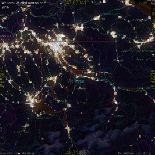
Analysis of Wollerau night lights 2016
Square area 10x10 km:
 0.45%
0.45%90-99
0.15%80-89
0%70-79
1.19%60-69
1.93%50-59
2.98%40-49
1.79%30-39
2.98%20-29
2.53%10-19
2.68%0-9
83.33%Square area 50x50 km:
1.97%90-99
1.68%80-89
0.74%70-79
1.21%60-69
1.68%50-59
1.56%40-49
2.07%30-39
1.89%20-29
2.61%10-19
6.18%0-9
78.43%Clear (daylight) street map image can be seen on geolist.org.
Map coordinates:
47° 40' 13.5" North, 8° 0' 57.3" East
47° 11' 41.2" North, 8° 43' 8.5" East
46° 42' 53.5" North, 9° 25' 19.8" East
Some cities around Wollerau sort by population:
• Rapperswil
8.5 km =5.3 mi,  66°
66°
• Freienbach
3.2 km =2 mi, 68°
• Wädenswil
5.2 km =3.2 mi,  313°
313°
• Einsiedeln
7.7 km =4.8 mi,  163°
163°
• Richterswil
2.1 km =1.3 mi, 307°
• Männedorf
7.1 km =4.4 mi,  347°
347°
• Pfäffikon
4.5 km =2.8 mi,  81°
81°
• Stäfa
5.3 km =3.3 mi,  3°
3°
2657955 (p: 6,883)
Sources (retrieved 2019-11-25):
» Earth at Night: Flat Maps 2012, 2016