Freienbach night lights from space
Night Light of Freienbach (Schwyz) from space (Switzerland) Src. Average luminocity for 10x10km area is 14.9658% and for 50x50km: 11.8241%.
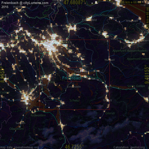
Analysis of Freienbach night lights 2016
Square area 10x10 km:
 1.34%
1.34%90-99
0.89%80-89
0.15%70-79
2.53%60-69
3.27%50-59
3.27%40-49
1.93%30-39
2.83%20-29
1.19%10-19
9.52%0-9
73.07%Square area 50x50 km:
2.07%90-99
1.81%80-89
0.79%70-79
1.19%60-69
1.83%50-59
1.58%40-49
2.09%30-39
1.92%20-29
2.54%10-19
5.74%0-9
78.44%Clear (daylight) street map image can be seen on geolist.org.
Map coordinates:
47° 40' 51.1" North, 8° 3' 19.1" East
47° 12' 19.2" North, 8° 45' 30.3" East
46° 43' 31.8" North, 9° 27' 41.6" East
Some cities around Freienbach sort by population:
• Rapperswil
5.3 km =3.3 mi,  64°
64°
• Jona
6.7 km =4.2 mi,  65°
65°
• Wädenswil
7.2 km =4.5 mi,  289°
289°
• Richterswil
4.7 km =2.9 mi,  271°
271°
• Pfäffikon
1.6 km =1 mi,  107°
107°
• Wollerau
3.2 km =2 mi,  248°
248°
• Stäfa
4.9 km =3 mi,  327°
327°
• Altendorf
6.3 km =3.9 mi, 105°
2660721 (p: 14,302)
Sources (retrieved 2019-11-25):
» Earth at Night: Flat Maps 2012, 2016